Showing posts with label castle. Show all posts

Wednesday, 30 September 2015

83 Widemouth Bay to Bude

Widemouth Bay

Only a short stretch of Coast Path today as I have hurt my ankle again. We continue along the back of the beach to reach the headland of Lower Longbeak. This is the view north with Higher Longbeak in the foreground and the white satellite dishes of Bude GCHQ in the background.


We walk along the cliff top to reach Higher Longbeak and quite a dramatically rocky shoreline. The tip of a pinnacle of rock has just caught the sun in the foreground.


Phillip's Point, at the end, has attractive folds of sandstone, unusual in Norther Cornwall.


Looking back, the stone pinnacle can be seen with a sort of stone doughnut behind it.


After the hamlet of Upton, the road which has been nearby heads off to the east and the path crosses an unexpected wide grassy area behind Efford Beacon and along to Compass Point on the edge of Bude. This is marked by Storm Tower built in sandstone in 1835. It is based on the Temple of the Winds in Athens and has the points of the compass marked on each of its eight faces.


Just beyond this you turn inland and walk above the sprawling beach and small harbour.


The beach huts on the opposite side provide a nice splash of colour.


Then you pass the massive sea lock which marks the end of the Bude Canal. This rather surprising structure was built in 1823 and runs only a few miles inland to merge with the river Neet. Its main purpose was the transportation of sea sand inland for use as a fertiliser. The sand was collected from the beach and conveyed by a narrow gauge railway to the jetty on the right of this picture.


We diverted slightly at this point to see Bude Castle, built in 1830 by the polymath and inventor Sir Goldsworthy Gurney.


In front of the castle is the rather lovely Bude Light, a millenium homage to Gurney by Carole Vincent and Anthiny Fanshawe. "The cone incorporates fibre optic star patterns which sparkle at night" (Pevsner). The colour-scheme is very pleasing.


Conditions: warm and sunny.

Distance: 3.4 miles (distance now covered 506.2 miles).

Grading: Easy.

Map: Explorer 111 (Bude, Boscastle & Tintagel)

Rating: Four stars, surprisingly interesting and emjoyable.

Wednesday, 24 June 2015

80 Trebarwith Strand - Tintagel - Boscastle

Trebarwith Strand

We set out from Trebarwith Strand: the tide was in and no beach was visible, just a large slab of rock. Gull Rock continued to dominate the horizon. We then made the steep climb up to the cliff-top, seeing our first Painted Ladies of the day, and soon had an impressive view back.


The route now continued at a comfortable cliff top level and we continued to see more Painted Ladies. At the end of this section we passed above a series of quarries, one of which had left behind an impressive column of rock. But why? 


We passed behind the two Penhallic Points (Lower and Higher), noticing the white sails of some boats out to sea, the first we have seen on this trip. Approaching Tintagel, we saw the imposing spire of the isolated church of St Materiana. Pevsner calls it the best small Norman church in Cornwall.


Soon after that we had our first view of the great rocky island, linked to the mainland by a narrow footbridge. 


We made a visit and learned that the great castle of Richard Earl of Cornwall from 1233 was in fact in two parts, one on the mainland and the larger on the island. The association with King Arthur is even older and goes back to Geoffrey of Monmouth's History of the English kings of 1133. 


We saw a seal in Tintagel Haven …


 … and several Scarlet Tiger moths flying around on the hillside.


There was also a great view of the next headland, Barras Nose, notable for being the first piece of coast to be owned by the National Trust. From this angle you can begin to see why it might be called Barras Nose.


After we finished our exploration of Tintagel, we resumed the Coast Path, passing behind Barras Nose and following the cliff round to the next headland Willapark, with the Two Sisters rocks just off it (the smaller sister is hidden behind the larger one). Beyond this a pleasant bay opened up with Firebeacon Hill and a large rock (Long Island!) at its end. The coast here was quite indented and we wondered what it would be like.


Soon we descended a little, but still passed high above the exquisite Bosinney Cove.


After a short climb we followed a broad grassy path towards Rocky Valley. This turned out to a well-named and absolutely beautiful winding river valley flowing into the sea. as it wound its way inland the valley opened and became picturesque rather than dramatic.


After a long steep climb up from the valley bottom, we continued at a high level. Soon a view towards a second headland called Willapool opened up. The white lookout station was clearly visible on top of the headland. I liked the large rock on the right, which seemed to me to suggest a dog or bear sitting upright. It appears that no-one else has spotted this.


A wide grassy path descended to another inlet and after a steep climb we passed inland of the second Willapool and its lookout station. I loved the pony to the right and imagined that the lookout had ridden to work. A notice explained that ponies were being grazed on the headland, so perhaps that was the explanation.


I had thought the Boscastle lay just beyond this headland but the path continued relentlessly onwards towards a sort of inlet. What could it be?


As we turned the corner, we discovered the good news: it was the mouth of the long, narrow harbour.


As the harbour ended a river began. It was as though we had suddenly been transported to the Cotswolds. Boscastle of course suffered terrible flash flooding in 2004 as the result of heavy rain. Happily, physically at least, it is now restored.

Conditions: Warm and sunny - a beautiful day to on the coast. Others clearly thought so too and this was the most crowded section of the coast path we have yet walked on.

Grading: Moderate.

Map: Explorer 111 (Bude, Boscastle and Tintagel).

Distance: 6.8 miles. Distance now covered 489.1 miles.

Rating: Five stars. One of the best and most varied sections.

Sunday, 21 June 2015

77 Rock to Port Quin


Padstow seen from Rock

We are back on the Coast Path and we start out from Rock by looking across the Camel towards Padstow. Almost immediately there is a fine view out along the estuary 


We follow a path along the back of the beach through dunes, where there are great number of Pyramidal Orchids.  We round Daymer Bay to reach the large sandy beach at Polzeath (pronounced Polzeth). There is some wonderfully stratified rock at the edge of this large sandy beach, clearly popular with surfers. 


After a short break for refreshments, we walk along the right side of the large beach ...


 ... and then head past New Polzeath to spot this lovely art nouveau influenced house, Medla,  overlooking a small bay.


We follow a path along the grassy headland towards Pentire Head, passing a sheltered area where we see lots of Small Heath butterflies and the odd Meadow Brown. The views from Pentire Head are stupendous: back to Polzeath …


…. and across Padstow Bay.


Rounding Pentire Head we soon come on Ramps Head, which seems to have a strong resemblance to a Stegosaurus (the darker of the humps is in fact a small offshore island, The Mouls). In this area we started to see Painted Lady butterflies in some numbers.


Passing behind Ramps Head brings us into Port Quin Bay and as the coast bends there is a view ahead to Kellan Head. Port Quin is in an inlet off this section of coast, but we can't tell which. 


At Carnweather Point there is a fantastic view back. The exciting thing was over to the left you can see right across the base of Pentire Point to the mouth of the Camel and the Daymark tower on the opposite bank. 


We pass behind Lundy Cove and then the delightful, but inaccessible, Epphaven Cove.


And soon we can see Doyden Castleon a hill in the centre, which we know is right by Port Quin.


Finally, we approach and then climb up to see Doyden Castle. It is basically square with bay windows on two sides. This "especially picturesque folly" (Pevsner) was built by Samuel Simms, a Wadebridge merchant, as a pleasure house. It is now a National Trust holiday cottage.


It is now clear that Port Quin lies some way up an inlet with an almost fjord-like character and the grassy path on the right led us to a road which led down to the port.


Conditions: Quite warm and sunny after the initial cloud cleared.

Grading: Moderate.

Map: Explorer 106 (Newquay & Padstow).

Distance: 8.6 miles. Distance now covered 472.2 miles.

Rating: Four and a half stars.

Wednesday, 11 June 2014

58 Porthleven to Praa Sands

Porthleven

We started today's leg by simply walking out of the pub where we have been staying and following the edge of the harbour. This gave us an excellent view of the wonderful Bickford Smith Institute at the start of the breakwater.

We made the inevitable climb out of Porthleven and enjoyed the view back along Porthleven Sands, i.e. yesterday's route.


A flat grassy section overlooking rocky ledges, gave way to a curving sweep of coast with several small inlets.

The route along here was up and down and as we entered a more over grown area we found ourselves engaged in quite an arduous climb to the top of Trequean Cliff. This led into Trewavas Cliff where we reached the former mine workings that we had seen across the bay. Wheel Trewavas has been restored by the National Trust and now presents a rather picturesque image just below the top of the cliff, high (well 60 odd metres) above the sea below. No doubt it was anything but picturesque to work there!


We now turned a wide grassy headland and descended towards Porthcew, also known as Rinsey beach. This pleasant sandy cove has a high grassy cliff at its back where another restored mine can be seen. This is Wheel Prosper. A helpful sign board explained that it was not in fact a success story and operated for only a few years before being closed. It did feature however in the once famous TV series Poldark.


We walked past Wheel Prosper and along a path somewhat back from the coast to soon be greeted by the great sweep of Praa Sands.


As we got closer, the headland of Prussia Cove and the other side of Mounts Bay could be seen beyond How Point which marks the end of Praa Sands. 


Praa Sands was the end for today because we were leaving the path to visit distant relatives who live there. On the way inland we were staggered to suddenly come on a castle by the side of the road.


This is Pengersick Castle, described by Pevsner as a "remarkable and important survival". He explains that it once formed part of a larger mid 16th century fortified manor, probably built by William Worth, of Worth in Devon.

Conditions: warm and sunny.

Distance: 5 miles (distance now covered 347.7 miles.

Map: Explorer 103 (The Lizard) and 102 (Land's End).

Grading: Strenuous becoming Moderate.

Rating: four stars.

Tuesday, 30 April 2013

32 Dartmouth to Torcross

Dartmouth Quay

We set out from Dartmouth Quay in bright sunshine on day 3 of our latest session of coast path walking. Very soon we reached Bayard's Cove Castle, a gun post dating from 1537, but built by the town, not by Henry VIII as so many other coastal fortifications were.


We followed the road down the estuary, pausing to enjoy the view back just before Warfleet.


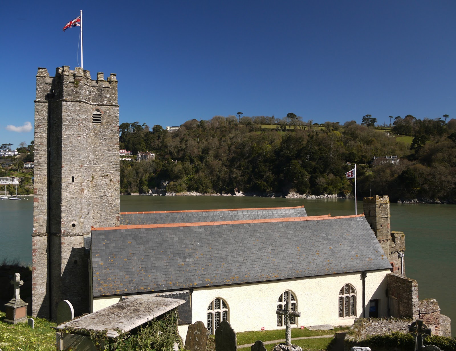
Soon after Warfleet you reach the strangely named St Petrox church - seemingly a corruption of St Peter's. Pevsner describes it as "an old foundation", but comments that the present building dates from 1648.

The nearby castle is visually disfigured by the presence of a lean-to tea room, but is a bit more visually pleasing from the grassy area above nearby Sugary Cove. The Open Spaces Society, a very worthwhile organisation which I had never previously heard of, seem to have been responsible for this pleasant open space.


The castle faces Kingswear Castle in such a way that a chain could be stretched across the river to block the estuary. It dates from about 1380 and was extended a hundred years later.

Further along, there was a fine view across the estuary to Kingswear Castle and, high on the hill to the right, the Tower day beacon inland from Froward Point. It was built in 1864 to guide ships into the estuary. The paddle steamer in the foreground offers leisure trips up the Dart.


Soon we turned Blackstone Point and had a clear view across the estuary to where we walked yesterday.

We climbed a grassy hill then walked across a meadow. As we did so, I spotted a large bird hovering above a neighbouring ploughed field. The binoculars confirmed what I immediately suspected: it was a Perigrine Falcon. We were told yesterday that they bred on the cliffs near Coleton Fishacre, and although we've walked six or seven miles since then it is probably only a mile or two as the predator flies. As ever, by the time I had begun to reach for my telephoto lens it flew off.

Before long we were walking along a grassy hillside and then had to turn inland to make a long detour through Stoke Fleming, where we had some refreshments at the lovely Green Dragon pub - and, perhaps mistakenly, did not visit the early 14th century church with its slender tower

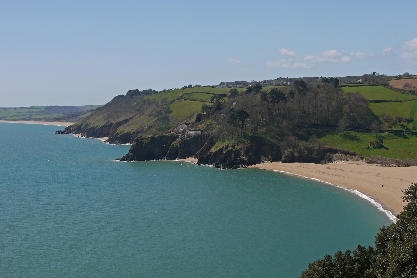
The path eventually returns to the coast above the lovely beach at Blackpool Sands.


We missed a turn here and walked further along the road than necessary, but then took the path on the left down a steep grassy hill and up the other side in the direction of Strete. This tree stood imposingly at the lowest point, overlooking a small cove.


As you approach Strete, the first clear view of Slapton Sands, with Slapton Ley behind it, is presented.


You follow the road through Strete and take a track which gently descends to the Sands at Strete Gate. It becomes clear that "Sands" is a bit of a misnomer as the beach is made of fine pebbles.

We followed the beach and later the Ley for two and a quarter miles to reach Torcross. The Ley is a surprisingly large body of freshwater, home to numerous ducks and legions of midges.


We ended our walk at the Sherman Tank. It is a monument to the loss of many hundreds of American servicemen who died when a landing rehearsal for D-Day was attacked by German E-boats in April 1944. The tank was recovered from the sea many years later.


Conditions: clear and warm, maybe 18 degrees.

Distance: 10.2 miles, a record for us. Distance now covered 164.6 miles.

Map: OL 20 South Devon.

Rating: Four stars.