Tuesday 30 April 2013

32 Dartmouth to Torcross

Dartmouth Quay

We set out from Dartmouth Quay in bright sunshine on day 3 of our latest session of coast path walking. Very soon we reached Bayard's Cove Castle, a gun post dating from 1537, but built by the town, not by Henry VIII as so many other coastal fortifications were.


We followed the road down the estuary, pausing to enjoy the view back just before Warfleet.


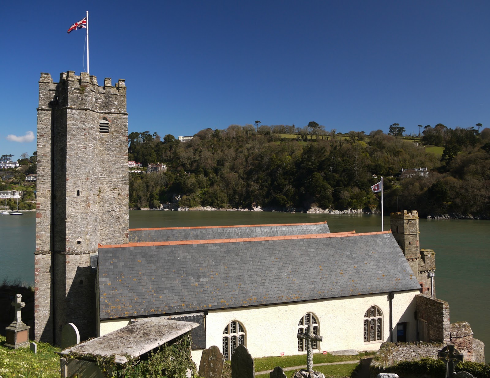
Soon after Warfleet you reach the strangely named St Petrox church - seemingly a corruption of St Peter's. Pevsner describes it as "an old foundation", but comments that the present building dates from 1648.

The nearby castle is visually disfigured by the presence of a lean-to tea room, but is a bit more visually pleasing from the grassy area above nearby Sugary Cove. The Open Spaces Society, a very worthwhile organisation which I had never previously heard of, seem to have been responsible for this pleasant open space.


The castle faces Kingswear Castle in such a way that a chain could be stretched across the river to block the estuary. It dates from about 1380 and was extended a hundred years later.

Further along, there was a fine view across the estuary to Kingswear Castle and, high on the hill to the right, the Tower day beacon inland from Froward Point. It was built in 1864 to guide ships into the estuary. The paddle steamer in the foreground offers leisure trips up the Dart.


Soon we turned Blackstone Point and had a clear view across the estuary to where we walked yesterday.

We climbed a grassy hill then walked across a meadow. As we did so, I spotted a large bird hovering above a neighbouring ploughed field. The binoculars confirmed what I immediately suspected: it was a Perigrine Falcon. We were told yesterday that they bred on the cliffs near Coleton Fishacre, and although we've walked six or seven miles since then it is probably only a mile or two as the predator flies. As ever, by the time I had begun to reach for my telephoto lens it flew off.

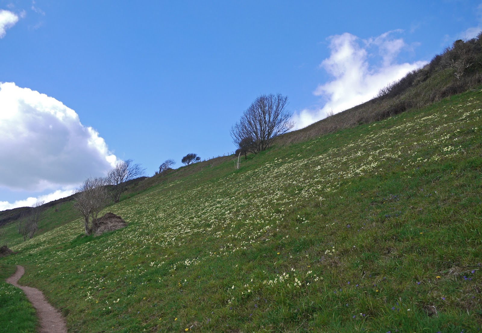
Before long we were walking along a grassy hillside and then had to turn inland to make a long detour through Stoke Fleming, where we had some refreshments at the lovely Green Dragon pub - and, perhaps mistakenly, did not visit the early 14th century church with its slender tower

The path eventually returns to the coast above the lovely beach at Blackpool Sands.


We missed a turn here and walked further along the road than necessary, but then took the path on the left down a steep grassy hill and up the other side in the direction of Strete. This tree stood imposingly at the lowest point, overlooking a small cove.


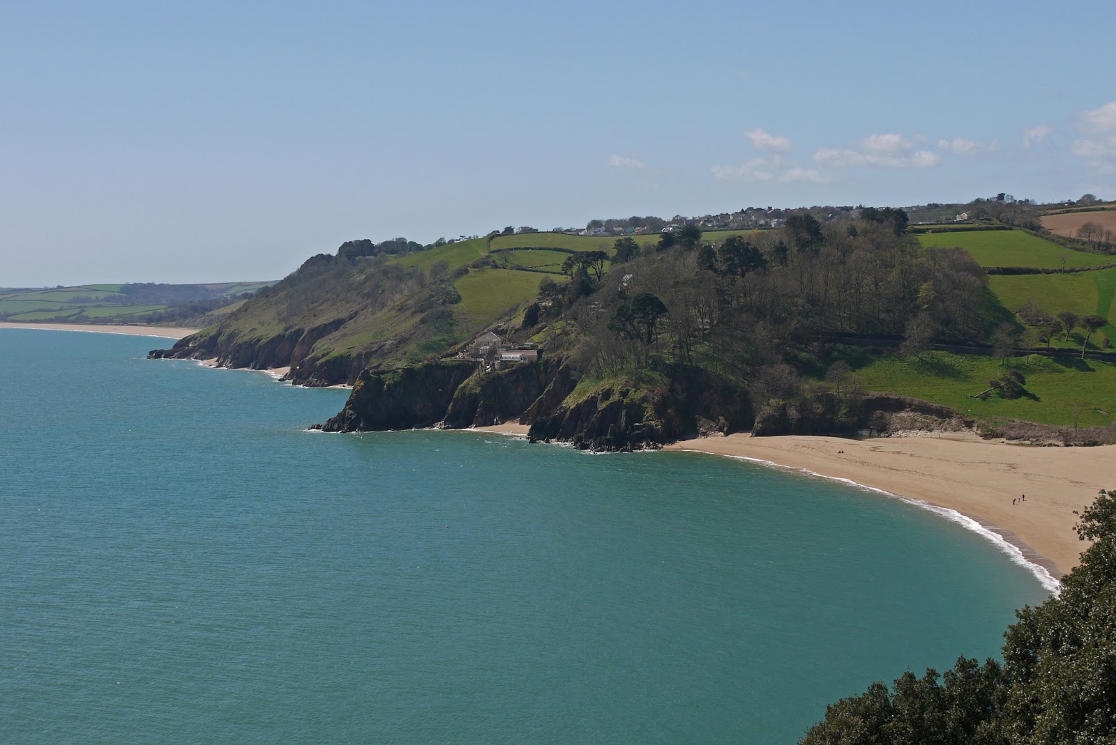
As you approach Strete, the first clear view of Slapton Sands, with Slapton Ley behind it, is presented.


You follow the road through Strete and take a track which gently descends to the Sands at Strete Gate. It becomes clear that "Sands" is a bit of a misnomer as the beach is made of fine pebbles.

We followed the beach and later the Ley for two and a quarter miles to reach Torcross. The Ley is a surprisingly large body of freshwater, home to numerous ducks and legions of midges.


We ended our walk at the Sherman Tank. It is a monument to the loss of many hundreds of American servicemen who died when a landing rehearsal for D-Day was attacked by German E-boats in April 1944. The tank was recovered from the sea many years later.


Conditions: clear and warm, maybe 18 degrees.

Distance: 10.2 miles, a record for us. Distance now covered 164.6 miles.

Map: OL 20 South Devon.

Rating: Four stars.

Monday 29 April 2013

31 Coleton Fishacre to Dartmouth

Coleton Fishacre

We decided to start our coast walk with a proper look at Coleton Fishacre. It is a 1920s house, built for Rupert and Lady Dorothy D'Oyly Carte by the architect Oswald Milne. It is set high above the coast, with the long valley below made into the beautiful garden for which the house is now especially, and deservedly, known. The interior is in a simple art deco style. Apart from the salon, it is much less grand than might be expected. This is the rear elevation.


After a very pleasant exploration, we walked down the slope to the back gate we had entered last night and resumed walking. After an initial climb, the path was flat for a while and we were struck by the incredible density of primroses on the hillside.


There was a fine view back to the far side of Pudcombe Cove.


And an even more dramatic one once we reached - after considerable ups and downs - Outer Froward Point.


The offshore rocks - Shooter Rock, Shag Stone and Mew Stone and their nameless companions - were both impressive and threatening.


Once we reached Inner Froward Point we began to see across the mouth of the Dart to a rather different-looking coastline.


Before long, we could see Dartmouth Castle and St Petrox church and the houses of Warfleet on the opposite bank.


Then, on our side. we came upon the Brownstone battery. It was built in 1940 to protect the Dart Estuary, Slapton Sands and Blackpool Sands (which we will pass tomorrow) from invasion. There were two gun emplacements, the other one is higher up, and searchlight stations at sea level. A railway conveyed shells to the gunners.


We climbed to reach the Coastguard station on the top of the point and now entered a wooded area called The Warren where walked on the level for a while, before the next descent and ascent. The route now continued on tarmac, with the estuary below and Kingswear Castle frustratingly hidden from view behind houses and trees.

Eventually we entered Kingswear and reached the Lower Ferry, the end of this leg of coast path, where we had parked our car. The view across to Dartmouth was delightful.


Looking to the right, the vast Royal Naval College dominates the hill.


Pevsner is fairly scathing about the College, the work of Sir Aston Webb in 1899-1905. In his view, it lacks "bombast" and neither the central tower nor the side cupolas are sufficiently imposing. I can only agree.

The Lower Ferry is closed at present so we drove round to the Upper one and made our arrival in Dartmouth. It was too late to start again on the coast path, so we had a little look around. I especially liked these houses, supported on columns - now the town Museum - which date back to 1640.


Next door to our B & B was the Cherub pub, said to date back to 1340 and to be Dartmouth's oldest building.

Finally, I took this evening shot of Kingswear - sadly the sun was temporarily behind clouds, but the light was still lovely.


Conditions: bright and warmer than yesterday, maybe 14 degrees.

Distance: only 3.5 miles along the coast path, but quite hard work. Distance now covered 154.4 miles.

Map: OL 20 South Devon.

Rating: Four stars.

Sunday 28 April 2013

30 Brixham to Pudcombe Bay/Coleton Fishacre


Brixham harbour

Today we embark on a four day assault on the Coast Path, starting at the breakwater in Brixham and walking up the hill towards Berry Head. Once we were in woodland, we were surrounded by a fabulous display of wild Cyclamen.


We soon became aware of the extensive presence of another plant, this one unfamiliar to us.


It is called Alexanders and is a member of the carrot family. It can be widespread and dense by the coast - as our experience was to testify - but is scarcely seen inland. One byproduct of our recent Cretan flower holiday is that we are trying harder to identify the wildflowers we see on our English walks.

A bit further on you emerge into a grassy area, behind Berry Head itself, where there are two forts built over 200 years ago to defend against attack by Napoleon.


Soon there is a fine view of St Mary's Bay with Sharkham Point on the left.


After passing a holiday village, there is a lovely wooden mermaid overlooking the cliff top. Was she from the prow of a real ship or just a copy? There is something very charming about stumbling on a piece of public art like this.


We wandered around Sharkham Point, bemused by the signposting which had suddenly gone missing, but eventually finding our way. Once at the tip, there is a good view back to Berry Head, with primroses in the foreground.


Looking in the other direction, the next section of coast is laid out before us. The bay with green hills beyond is Man Sands.


The path now winds up to the top of Southdown Cliff, with primroses in profusion along both sides. We walked along the cliff-top (120m), a pleasant break from ups and downs, but soon had to begin the long descent to Man Sands. The isolated Coastguard Cottages are very striking and can been seen from far away.


We had a break for lunch sitting on some comfortable rocks at the back of this spacious beach and climbed back up to the cliff top, now above Long Sands. This is the view back, with Crabrock Point in the foreground and Man Sands partly hidden beyond it.


After a while we descended again, this time to Scabbacombe Sands.


Then it was back up and round Scabbacombe Head, where the coastline began to change. There were no longer higher cliffs which you walked above, but rather a more inclined coastline, where the path was at mid-slope.


The other momentous change which begins somewhere around here is that when you look back you can see only open sea. Previously, you have been able to see the coast of South Devon and Dorset and often as far as Portland.

After quite a few more ups and downs we reached our target for today: Pudcombe Cove (viewed from on high).

We now sneaked through the back gate of the National Trust property, Coleton Fishacre - which we will visit properly tomorrow - and walked up to the road where we met a taxi. Almost inevitably when we went to phone for it there was no mobile signal, but we prevailed on a very kind householder to lend us her landline, which she did very graciously.

Conditions: bright, but cool, maybe 9 degrees.

Distance: 7.5 miles. Distance now covered 150.9 miles.

Map: OL 20 South Devon.

Rating: Four stars. A very flowery walk. Apart from the Cyclamen, Alexanders and Primroses, there were large numbers of Violets, Greater Stitchwort, White Campion and Bluebells, and large areas of Broom.