Showing posts with label art deco. Show all posts

Saturday, 3 June 2017

96 Croyde Bay to Woolacombe

Croyde Bay

It's a rather grey morning as we walk away from the northern end of Croyde Sand and it soon starts to rain. The surfers on the beach don't seem to mind however.

Soon there is a fine house overlooking the sea. It is in a sort Charles Rennie Macintosh / art deco style and we can't decide if it is a new build or whether the glass area to the left is a recent addition.


It is certainly an interesting building. Google reveals that it is called Baggy House and is new(-ish) - 1994 in fact and designed by Hudson Architects.  You can see many impressive pictures on their website. Why Baggy House? It is on the peninsular which leads to Baggy Point.

We carry on past this house towards Baggy Point, along a track on a low cliff-top. This is the view back to Croyde Bay. The square shape on the extreme right is a new lighthouse-style house which will allegedly be featured at some point in the future on Grand Designs.


We pass a sign telling us that the land is in the care of the National Trust. Their website has an extract from the North Devon Journal of 11 May 1939: "It is announced that Misses Constance and Florence Hyde of Baggy Point, Croyde, have presented to the Trust the whole of Baggy Point."

The Point itself– which we were very conscious of when we were walking along the other side of Bideford Bay – turns out to be a low and fairly innocuous headland, currently occupied by a flock of black sheep. The

We climb up over the edge of a hill and soon find ourselves on the other side of the peninsular. This side is Morte Bay and it is immediately noticeable how much calmer and milder it is. The long sandy Beach of Woolacombe Sand can be seen over to the right.


And this is the view back towards Baggy Point.


The southern end of Woolacombe Sand is called Putsborough Sand and this is home to a caravan park, right at the back of the beach.


From this angle, Morte Point, which marks the end of Morte Bay, can be seen to the left.


Our route takes us inland initially as we climb gradually up the hillside behind the beach. After a while we make a sharp descent to emerge on a sandy path behind the dunes at the back of the beach. It's quite pretty with lots of wild rock roses and we see a good number of Stonechats doing their thing from the tops of bushes. But it's odd not to be able to see the sea. Walking on sand is quite hard going too and overall we wish we were had taken a route along the firm sand near the waterline of the beach.  At length we arrive in Woolacombe: undistinguished, but doubtless a good place for a beach holiday.

Conditions: Cloudy, becoming brighter. Mild.

Distance: 6.3 miles.

Map: Explorer 139 (Bideford, Ilfracombe & Barnstaple).

Grading: Moderate.

Rating: three and a half stars.

Monday, 22 May 2017

95 Braunton Burrows to Croyde Bay

Braunton Burrows and Staunton Sands

We picked up the Coast Path at Sandy Lane car park and continued to walk along a track with the dunes of Braunton Burrows between us and the sea. before very long I had spotted some more Speckled Woods (yesterday's was the first of the year) and a Comma (another first).

We passed through a golf course and emerged onto the Braunton to Croyde road at Saunton. We took an inland detour and were quickly rewarded by the sight of a lone Holly Blue (again my first of the year - as I write this I have just seen another in my garden) soon passing St Anne's chapel (1897), located in a rather lovely wooded setting. According to Pevsner it was intended to be the chancel of a larger church which was never built.


Returning to the road, we took a left which headed down to the car park behind Saunton Sands and headed uphill to rejoin the road. Above us was the imposing bulk of the art deco Saunton Sands Hotel (by Alwyn Underdown, about 1937).


As we climbed, we had our first view of the actual sea since a brief glimpse at Instow two days ago. It has been really strange walking so many miles along the Coast Path without being able to see the sea.


Further up the vast expanse of sand becomes visible, with the sand dunes behind on the left.


We crossed the road and climbed to follow a path along the side of the hill. This felt like the real Coast Path at last. An open path, flowers and grass on either side, views over the sea - and, as a special bonus, absolutely loads of Peacocks. Amazing to think that I saw my first of the year only two days ago. We passed around the headland and passed a building our taxi driver had told us about: a lighthouse-style structure right in the headland being built for some magnate and scheduled to appear on TV next year.


A little further on another modern house was nestling into the roadside. Rather a nice house I thought, but don't they have planning controls around here?


In the background is Croyde Sands, which we soon reached. Our first sight was of strata of rock twisted into what seemed to be right-angles from its original position.


Behind the large sandy beach were some inviting dunes.


We walked across the back of the beach and reached the car park at the far end where we had left the car.


Distance: 5 miles.

Grading: Easy.

Map: Explorer 139 (Bideford, Ilfracombe & Barnstaple)

Rating: Four stars.

Tuesday, 2 June 2015

75 Treyarnon Bay to Trevone Bay


It's been raining for about 20 hours since we reached Treyarnon Bay yesterday. The forecast for today is encouraging, but as we set off again it is grey and drizzling. Passing round Treyarnon Point we reach the vast expanse of the lovely Constantine Bay and walk its full length along the softish sand. Above is the rather hazy view back.

At the end you climb a few steps and pass into Boobys Bay. This is more rocky and the path follows the grassy area to the back of the beach. Inland there are a few scattered houses and we especially liked this 1930-ish one in the style of Edward Lutyens.


We plodded on, passing behind Dinas Head to reach Trevose Head, whose white lighthouse we have seen intermittently since Newquay. That its light was on is indicative of the prevailing murk. 


I wanted to see the lighthouse more closely and we followed the road from behind the headland into a sort of courtyard where we were impressed by the pedimented entrance to the lighthouse and the four attached cottages forming a sort of courtyard.


A bit further on we turned a further unnamed headland and the weather miraculously relented - the sun broke through the clouds. We passed this fantastic art deco house above a small bay ...


... and soon reached Mother Ivey's Bay. There was a large holiday park behind the sandy beach. The back of the beach great views back to the newish Padstow lifeboat house and the Merope Rocks. 


We rounded Cataclews Point to reach the simply huge Harlyn Beach.


We followed the path above the beach around the right side and then had to descend and walk the last bit along the sand. In the far right corner a small river enters the bay under a bridge and we reached the road there near to a welcoming pub where a wedding party were celebrating in what was now warm sunshine.

After a refreshing drink we walked around the grassy headland to Trevone Bay, where it was a pleasure to see another of these lovely sandy beaches being used for its true purpose.


Conditions: wet at first, but eventually quite sunny. A high wind throughout.

Grading: Easy.

Map: Explorer 106 (Newquay & Padstow).

Distance: 6.0 miles. Distance now covered 458 miles.

Severity: Moderate.

Rating: Four stars.

Friday, 11 July 2014

59 Praa Sands to Penzance


We rejoin the Coast Path at the lovely Praa Sands. (We pronounce the name as Pra, but our taxi driver, Ian, tells us the locals pronounce it Pray.) As we climb up away from the beach there is a nice view back which includes one of last time's surprises, Pengersick Castle. The RNLI lifeguards can also be seen on the beach getting ready for another day's work.

We pass round the back of Hoe Point and the wide sweep of Kenneggy Sand lies before us.


On the left is what seems to be a large private house, unusually positioned right on the shoreline. We walked around the back of the cove, past some holiday cottages and behind the large house to then pass Bessy Cove. A little further on we were delighted to see Fulmars nesting in the cliffs above Piskies Cove.


We were now seeing lots of Gatekeeper butterflies: the first of the year. We also saw five or six examples of the rather splendid Magpie Moth.


Soon we reached Cudden Point which offered a good view back along the rocky coastline. 


The next section followed a cliff top path with the same sort of rocky ledges below and as we approached Perranuthnoe we had our first clear view of St Michael's Mount under increasingly cloudy skies.


We paused for an early lunch at the excellent Victoria pub in Perranuthnoe and continued, now in drizzle, towards Marazion. St Michael's Mount and its causeway became progressively clearer, but the weather showed no sign of improving.


Probably the most interesting view was from Marazion, with the tide coming in and the narrow causeway mostly under water. St Michael's Mount was given to the Benedictines, the same order as had possession of Mont Saint Michel in France by Edward the Confessor in the 11th century. There are still remnants of a 12th abbey and castle. The abbey was sold after the Dissolution of the Monasteries, passing into the hands of the St Aubyn family in 1657. The family still live there, although the property is now owned by the National Trust. 


It remained only to walk the 2.5 miles to Penzance along the footpath at the back of the wide sandy beach. This was not enhanced by the poor state of the footpath or by the increasing gloom and drizzle.


We passed the Jubilee Pool on the way to our B&B. It dates from 1935 and is in restrained art deco style. From the outside the white painted concrete seems excessively functional and rather ugly.


But the internal view has a kind of stern elegance. The pool is currently shut because of storm damage, so of which can be seen in the picture and there is doubt about whether it will reopen. It is Britain's largest remaining lido.


Opposite is the art deco Yacht Inn.


It's not on the coast, but I can't leave this post about Penzance without mentioning the Egyptian House in Chapel St.

This extraordinary building dates from 1835-6 and was built for John Lavin as a showroom for his mineral and fossil dealership. (Why this required an Egyptian theme is less obvious, although Pevsner implies it was something of a fashion at the time.)

Conditions: mild but grey, later on drizzle then rain.

Distance: 8.9 miles (distance now covered 356.6 miles.

Map: Explorer 102 (Land's End).

Grading: Moderate.

Rating: four stars.
Monday, 29 April 2013

31 Coleton Fishacre to Dartmouth

Coleton Fishacre

We decided to start our coast walk with a proper look at Coleton Fishacre. It is a 1920s house, built for Rupert and Lady Dorothy D'Oyly Carte by the architect Oswald Milne. It is set high above the coast, with the long valley below made into the beautiful garden for which the house is now especially, and deservedly, known. The interior is in a simple art deco style. Apart from the salon, it is much less grand than might be expected. This is the rear elevation.


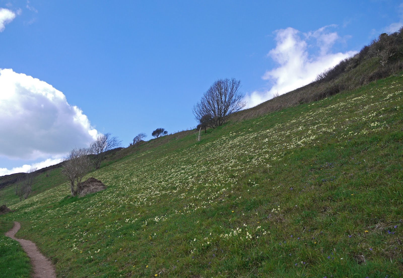
After a very pleasant exploration, we walked down the slope to the back gate we had entered last night and resumed walking. After an initial climb, the path was flat for a while and we were struck by the incredible density of primroses on the hillside.


There was a fine view back to the far side of Pudcombe Cove.


And an even more dramatic one once we reached - after considerable ups and downs - Outer Froward Point.


The offshore rocks - Shooter Rock, Shag Stone and Mew Stone and their nameless companions - were both impressive and threatening.


Once we reached Inner Froward Point we began to see across the mouth of the Dart to a rather different-looking coastline.


Before long, we could see Dartmouth Castle and St Petrox church and the houses of Warfleet on the opposite bank.


Then, on our side. we came upon the Brownstone battery. It was built in 1940 to protect the Dart Estuary, Slapton Sands and Blackpool Sands (which we will pass tomorrow) from invasion. There were two gun emplacements, the other one is higher up, and searchlight stations at sea level. A railway conveyed shells to the gunners.


We climbed to reach the Coastguard station on the top of the point and now entered a wooded area called The Warren where walked on the level for a while, before the next descent and ascent. The route now continued on tarmac, with the estuary below and Kingswear Castle frustratingly hidden from view behind houses and trees.

Eventually we entered Kingswear and reached the Lower Ferry, the end of this leg of coast path, where we had parked our car. The view across to Dartmouth was delightful.


Looking to the right, the vast Royal Naval College dominates the hill.


Pevsner is fairly scathing about the College, the work of Sir Aston Webb in 1899-1905. In his view, it lacks "bombast" and neither the central tower nor the side cupolas are sufficiently imposing. I can only agree.

The Lower Ferry is closed at present so we drove round to the Upper one and made our arrival in Dartmouth. It was too late to start again on the coast path, so we had a little look around. I especially liked these houses, supported on columns - now the town Museum - which date back to 1640.


Next door to our B & B was the Cherub pub, said to date back to 1340 and to be Dartmouth's oldest building.

Finally, I took this evening shot of Kingswear - sadly the sun was temporarily behind clouds, but the light was still lovely.


Conditions: bright and warmer than yesterday, maybe 14 degrees.

Distance: only 3.5 miles along the coast path, but quite hard work. Distance now covered 154.4 miles.

Map: OL 20 South Devon.

Rating: Four stars.