Showing posts with label North Cornwall. Show all posts

Sunday, 26 March 2017

86 Morwenstow to Hartland Quay

Henna Cliff

We set out from Morwenstow completing the detour route we encountered yesterday. This meant that we didn't get to see the celebrated Hawker's Hut. (Robert Stephen Hawker, 1803-1875, was the local clergyman, and also an antiquarian and poet. The hut in which he spent many hours writing poems and smoking opium, is mainly of timber construction and is partially built into the hillside with a turf roof. It was originally built from driftwood and timber retrieved from shipwrecks.

When we reached the coast, our first challenge appeared: Henna Cliff, which first required a descent to sea level to Morwenna's Well – a stream in fact, no sign of a well as such. This was followed by a climb to about 140m.

On the way up there was a nice view back to Higher Sharpnose Point, one of the highlights of yesterday's short section.


At the top there was another fine view backwards.


And the coast as far as Hartland Quay and the Hartland lighthouse stretched out ahead.


After a brief section along the cliff top we descended to the curiously named Westcott Wattle 


and climbed the grassy Yeolmouth Cliff. This provided us with a sight of the interesting, but unimaginatively named Gull Rock.


We descended again to Litter Mouth – we now realised that wherever you see the word "mouth" on the map in this part of the world, it denotes the mouth of a river, or more likely a small stream, and you face a descent and immediate ascent. The steps up were quite hard work. At the top we had a fine view of the adjacent Marsland Mouth and Welcombe Mouth.


 Marsland Mouth was especially complicated with the stream following a winding course through deeply indented ground. We were surprised to see a substantial house at the back of the cove.


The climb up was very steep, but did reveal our first butterfly of the day, a Painted Lady. Near the top was Ronald Duncan's hut, a sort of modern version of Parson Hawker. Duncan was, according to an information sheet on the wall a "poet, playwright, journalist, farmer and lover".


There was no respite at the top, simply an immediate descent to Welcome Mouth. This marked the boundary between Cornwall and Devon. 


As we began the ascent out of Welcombe Mouth we took great heart from a sign post telling us that it was now only 4 miles to Hartland Quay. We knew really that it couldn't be right and it actually turned out to be 5.5 miles. This is not the first time a sign post has been wildly inaccurate - how does it come about?

My reading of the map suggested that we would now follow the cliff top for a a good while and this turned out to be right. We started to see more butterflies: Large Skipper, Meadow Brown (the first of the year), Common Blue, another Painted Lady. 

After Emburey Beacon, the terrain began to change and the view ahead showed fields.
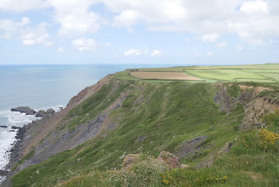

At Nabor Point there was a dramatic view of the coast ahead.


But soon we were routed away from the coast and along a road for a short while before again heading back to it along field edge paths. We continued along the cliff top until at Longpeak the path continued inland away from the coast along an inviting valley.


 Here we saw Large and Small Whites and some Green Hairstreaks. This valley met another valley where we turned left towards the lovely Spekes Mill Mouth.


This inevitably triggered another climb after which we passed inalnd of St Catherine's Point with its dramatic triangular rock thrusting up into the sky.


Shortly afterwards Hartland Quay hove into view.


This, finally, was the dramatic view of the coast ahead seen from the Wreckers pub at Hartland Quay. 

Conditions: cloudy at first, later bright and sunny.


Distance: 8.0 miles.


Map: Explorer 126 (Clovelly & Hartland).

Grading: Severe. 


Rating: five stars.

Friday, 24 March 2017

84 Bude to Duckpool

View of Bude on a nice sunny day

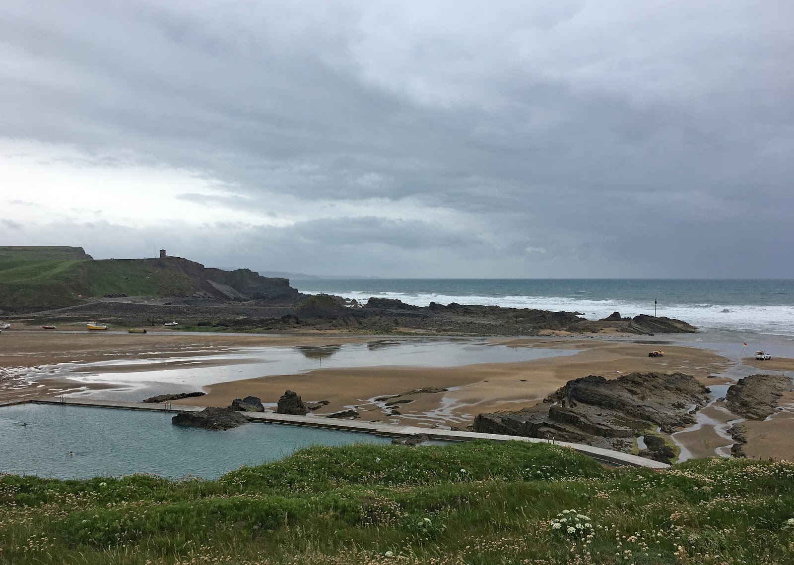
The weather forecast for today's short stage of the Coast Path was pretty dire and we set out from Bude under heavy grey skies, hence the picture above from when we were last here. We started from the famous sea lock and walked across the sand towards the Bude Sea Pool.


It was created in the 1930s as a semi-natural pool, measuring 91m long by 45m wide, fitted under the curve of the cliffs. There were a few brave souls in there this morning, although three out of four of them were wearing wet suits.

We climbed the steps at the back and enjoyed the view back towards the Storm Tower on the opposite cliff.


We soon climbed up to Maer Down and the start of the long run of cliff, broken only by a series of narrow river valleys which extends all the way to Hartland Quay. The tide was out revealing small patches of sand interspersed with large areas of rock. The first headland in the photo is Menachurch Point.


The next section undulates along the grassy cliff top with the same sand and rock combination on the beach. It is beginning to look as though we might be spared the forecast rain.


As we continued along here we saw activity just in front of the two pointed rocks. Two people in red were moving flags on the beach. What were they up to?


As we got closer we realised that they were lifeguards who were demarcating a narrow safe area on the beach at Sandy Mouth. This photo shows the twisting route of the small stream as it makes its way to the sea.


There was a decent climb up from Sandy Mouth and then we were high enough to get our first proper view of the GCHQ operation on the plateau above Steeple Point.


Soon there was another sharp descent and ascent.


And this led to the final slippery descent down to the car park at Duckpool.


Conditions: Grey, with a constant threat of rain. I left my camera behind and used my iPhone for today's pictures.


Distance: 3.7 miles.


Map: Explorer 126 (Clovelly & Hartland)

Grading: Severe. 

 
Rating: four stars.

Wednesday, 30 September 2015

83 Widemouth Bay to Bude

Widemouth Bay

Only a short stretch of Coast Path today as I have hurt my ankle again. We continue along the back of the beach to reach the headland of Lower Longbeak. This is the view north with Higher Longbeak in the foreground and the white satellite dishes of Bude GCHQ in the background.


We walk along the cliff top to reach Higher Longbeak and quite a dramatically rocky shoreline. The tip of a pinnacle of rock has just caught the sun in the foreground.


Phillip's Point, at the end, has attractive folds of sandstone, unusual in Norther Cornwall.


Looking back, the stone pinnacle can be seen with a sort of stone doughnut behind it.


After the hamlet of Upton, the road which has been nearby heads off to the east and the path crosses an unexpected wide grassy area behind Efford Beacon and along to Compass Point on the edge of Bude. This is marked by Storm Tower built in sandstone in 1835. It is based on the Temple of the Winds in Athens and has the points of the compass marked on each of its eight faces.


Just beyond this you turn inland and walk above the sprawling beach and small harbour.


The beach huts on the opposite side provide a nice splash of colour.


Then you pass the massive sea lock which marks the end of the Bude Canal. This rather surprising structure was built in 1823 and runs only a few miles inland to merge with the river Neet. Its main purpose was the transportation of sea sand inland for use as a fertiliser. The sand was collected from the beach and conveyed by a narrow gauge railway to the jetty on the right of this picture.


We diverted slightly at this point to see Bude Castle, built in 1830 by the polymath and inventor Sir Goldsworthy Gurney.


In front of the castle is the rather lovely Bude Light, a millenium homage to Gurney by Carole Vincent and Anthiny Fanshawe. "The cone incorporates fibre optic star patterns which sparkle at night" (Pevsner). The colour-scheme is very pleasing.


Conditions: warm and sunny.

Distance: 3.4 miles (distance now covered 506.2 miles).

Grading: Easy.

Map: Explorer 111 (Bude, Boscastle & Tintagel)

Rating: Four stars, surprisingly interesting and emjoyable.

Tuesday, 29 September 2015

82 Crackington Haven to Widemouth Bay

The towering headland of Pencannnow Point

We pick up the coast path at Crackington Haven and start by climbing up to Pencannow Point, which we pass to the back of. The tide is out today and there is a nice view back towards Cambeak.


Next up is a steep descent into a long valley and then a corresponding climb up the other side.


Once at the top, an inviting ridge stretches out ahead.


Across the valley the spire of St Genny's church is visible. The ridge continues and at the end then is a lovely view back down the valley. 


There now follows a section of high grassy cliff (Lower Tresmorn) which ends with a vertignious descent down to just above a seemingly unnamed inlet.


The inland valley is (or was) known locally as Butterfly Valley and once was home to a colony of the rare Large Blue butterflies which became extinct in the late 1970s. We have been seeing a reasonable selection of butterflies as we walk along: Large and Small Whites, Red Admiral, Small Tortoiseshell, Speckled Wood, but now to great excitement we spot our first Clouded Yellow of the year.

The opposite side is Chipman Cliff, a steep and slippery climb.


The next section along the cliff top is reasonably level and views of our destination, Widemouth (pronounced Widmuth) Bay soon become available.


This area is called The Dizzard and is notable for the tree-lined slopes leading dpwn to teh sea. Theer are Sessile Oaks, Mountain Ash, wild Service Tree, Beech, Hawthorn and Blackthorn. It is said to be a remnant of the prehistoric forest which once covered the whole country.  Briefly the path dips down into the woods near Bynorth Cliff and then continues until above Milloook.


 Here it joins the road which passes behind the strange rocky cove with its gravelly beach - apparently a sort of geological heaven with extraordinary rock formations. It leads to another steep climb (we have a leaflet produced by the North Cornwall Heritage Coast and Countryside Service which describes it as one of the steepest on the coast path and we are not inclined to disagree). A further clifftop section rejoins the road above Wanson Mouth where the coast continues to have a sort of black rocky reef. It is probably rather a crass comment, but we found this whole stretch of coast rather gloomy and oppressive - where were the nice sandy beaches we had seen previously in North Cornwall?

On this section of road our day was brightened hugely by the sight of a newly emerged Painted Lady which offered a lovely image with the sun behind its wings.


 At the bottom of the hill we took a path on the left to reach and then walk behind Widemouth Bay.


The North Cornwall Heritage Coast and Countryside Service leaflet mentioned earlier describes this as "one of the finest sandy beaches in North Cornwall". To be honest, having seen several sandy beaches in North Cornwall, I have to say that they must be joking. I would go for "dismal".

Conditions: warm and eventually sunny, but hazier than yesterday.

Distance: 6.8 miles (Distance now covered 502.8 miles - woo hoo!)

Grading: Strenuous.

Map: Explorer 111 (Bude, Boscastle & Tintagel)

Rating: Four stars, principally for the first section.

Monday, 28 September 2015

81 Boscastle to Crackington Haven


Boscastle

We are back on the South West Coast Path after a summer break - Cornwall is just too crowded in the summer - and we pick up our route at Boscastle. We walk up right hand side of the stream which flows into the harbour and past the tea shop with its pretty gothic windows to look down over the harbour where the tide is out.


We climb the steep cliff behind Penally Point and head along at cliff top level with the coast stretching away ahead to the oddly named headland of Cambeak.


We are already starting to see lots of Small Tortoiseshell and Red Admiral butterflies and this would continue for the rest of the walk. We make the first of several steep descents from Hillsborough to reach a cove called Pentargon, where there is apparently a waterfall when conditions are right. Not today though. There is a nice view out to sea however.


Now we climb Beeny Cliff and continue on a mid-cliff path with the rocks called the Beeny Sisters out to sea, a known spot to see seals. Two women walkers we passed had paused to do just that, although we couldn't see any ourselves.


Now we were on a high cliff path with next section to Cambeak stretching out before us and looking rather bleak it must be said. We didn't realise until we had climbed up to it, but the rocky bluff on the right is High Cliff, unimaginatively named but at 223m just beats Golden Cap in height and is apparently the highest sea cliff in Cornwall. (The only higher one in England is Great Hangman near Combe Martin in North Devon, which is 318m.)


At Rusey Cliff there was clearly going to be a substantial descent and then climb and in fact the path went further down towards the sea than I had realised when taking this picture.


 The long steep ascent on the other side brought us to High Cliff, and a grassy area just beyond. The view was green and inviting, allowing us to dream that the hard climbing is all over.


Soon you begin another descent and the distinctive rock formations of this section of coast become clearer: Samphire Rock (one of the few such rocks not called Gull Rock), Northern Door (a natural sea arch, although it appears on closer inspection to have been bolstered with some stone blocks) and Cambeak.


On the descent we spotted to the left a number of goats with long curved horns.


As you get closer, Cambeak looks for all the world like stone monster: head, eye, mouth, neck, body.


Time for another descent and then a steep climb, eschewing the obvious shortcut to the right, to climb Cambeak and enjoy a fine view toward our destination, Crackington Haven.


 Just another steep 50-step climb bars the way and soon we are descending the cliff towards the village. It looks nothing much, but apparently the high water conceals a sandy beach and at low water it is a popular destination.


Conditions; remarkably warm and sunny.

Distance: 6.8 miles (distance now covered 496 miles).

Grading: Strenuous.

Map: Explorer 111 (Bude, Boscastle & Tintagel)

Rating: Four stars.