Looking back towards St Aldhelm's Head
After a two months' gap, today offered an opportunity to resume our progress, by means of circular walks, along the South West Coast Path. We started at a car park to the west of Kingston, just by the entrance to Encombe Park, and walked back along the lane to the village. There were fine views to the left towards Corfe Castle. You could very clearly see the way in which the castle perches on a self-contained hill, with the Purbeck ridge rising on either side of it. What led to the interruption of the ridge?
In Kingston, we turned visited the church of St James and then turned right towards the sea. We were pleased to immediately identify it as Victorian. It turns out to be by the eminent architect G E Street and was built in the 1870s, lavishly funded by the third Earl of Eldon. Pevsner describes it as his (Street's) "grandest church in the country".
We followed the road due south as it gradually became a track. After about a kilometre, we forked left on a permissive path aiming for the precise point at which we left the Coastal Path in April. We were pleased to find it successfully, but something went slightly awry because we had to carefully climb over a barbed wire fence at the end.
The path is a long way inland here, forced away from the coast by the steep ravine at the back of Chapman's Pool. As we walked along we could see the rocky side of Emmetts Hill, and remembered the many steps we had climbed up to reach it on the last leg from Winspit to Chapman's Pool.
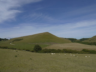
Soon the path opened out into a wide glacial valley as we curved round under a fine rounded, but seemingly unnamed, hill 136m above sea level. When then took a path on the left, leading right down to the coast. This is the view back.
Now we climbed this leg's set of steps: about 200 of them leading up to the top of Houns Tout cliff, at 140m. The view back towards Chapman's Pool and St Aldhelm's head was exhilarating.
We were delighted to find a sun-warmed stone bench looking west and sat there for a while taking a breather and enjoying the view towards Rope Lake Head - the second headland in the picture, the first is Egmont Bight.
There now followed a long descent and then a relatively flat section, with Swyre Head, the highest point along the Dorset coast at 203m, rising to the right.
Just before Rope Lake Head, we took the path which leads, over a kilometer or so of steady climbing, to the top of Swyre Head. We came this way in January walking from Kimmeridge, to the west, so we knew exactly what to expect. Last time, it had been raining and the slippery mud added considerably to the difficulty. Today it was dry, but still a decent climb.
As we approached the top, with a hint of early sunset, the view to the west towards Kimmeridge Bay opened up.
The final stage back to the car park followed the line of the ridge overlooking the stretch of coast we had just walked along. The curve of the ridge mirrored the curve of the coastline. In the valley below Encombe House nestled, almost invisibly, in its private park.
Conditions: sunny, hot.
Distance: about 6 miles, of which about about 3 was on the Coast Path. Distance covered now 19 miles.
Map: Explorer OL15 (Purbeck and South Dorset)
Rating: four and a half stars
Sightings
Quite a good day for butterflies: Large and Small White, Meadow Brown, Small Heath, Small Tortoiseshell, Speckled Wood, Painted Lady (our first of the year), Large Skipper, and two Blues - I think Silver Studded and Adonis.
On the bird front, we watched a Kestrel circling around the cliff edge at Houn's Tout and admired the gliding flight of a number of Fulmars. Later we saw a small flock of Goldfinches and a pair of Yellowhammers. The highlight though was to definitively identify some Stonechats: a male, a female and a chick.
Flower of the day
This Viper's Bugloss grew in a number of places on the top of Houn's Tout. I have had it as my Flower of the Day before, but never in such a dramatic location.


No comments:
Post a Comment