Wednesday, 8 August 2012

23 Branscombe to Sidmouth

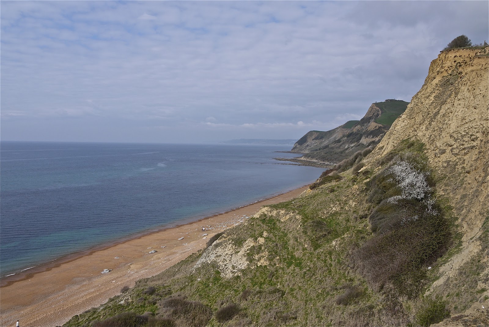
Looking west towards Sidmouth

Day 3 of our Coast Walking trip to Devon. We drove to Branscombe, where we left off yesterday, parked outside the church and climbed up to rejoin the coast path. We fairly soon emerged out of the woods, passed a couple of parked cars (how did they get there? should we have done the same?) and reached the open cliff top (Berry Cliff) with the first, rather hazy, views towards Sidmouth - today's destination.

A bit further on, the view became a little clearer, and we could make out the long sweep of coast from Sidmouth down to Otterton Ledge and the mouth of the Axe beyond, with Torbay further in the distance.


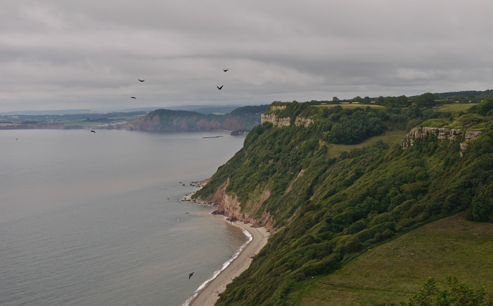
There followed a flat grassy section above Littleton Shoot, with more mysteriously parked cars, and the we could see the pebble beach of Weston Mouth, the first major descent on the walk - and the equally major climb waiting on the other side. The birds in the photo are ravens, which roost in the undercliff. We saw one quite close up sitting on a fence post and were impressed with its size.

The path takes you down right to the back of the beach, across the mouth of a pretty stream ...


 ... and through fields up the edge of the opposite cliff. We were very pleased to emerge a bit later on to Lower Dunscombe Cliff, a pleasantly undulating area, with hillocks covered in wild flowers and butterflies. The cliff itself was rugged and eroding.


After a short detour inland at Linchcombe, Higher Dunscombe Cliff was flatter and more agricultural than its Lower neighbour. The first clear view of Sidmouth opened up as we approached Salcombe Mouth, the second major descent/ascent.


This time at least it wasn't necessary to go right down to the sea before beginning to climb again. The view looking back to Higher Duncombe Cliffs and the shoreline below from the hill west of Salcombe Mouth was dramatic. It is a bit puzzling that this dramatic viewpoint doesn't seem to have a name.


Now we walked along Salcombe Hill Cliff and emerged to find a simply wonderful viewpoint over the town and its two bays.


A final winding, but quite gentle, descent, by comparison with the others, brought us to Sidmouth esplanade. The terraces with their verandahs date from 1837.


The Sidmouth Folk Festival was on, unbeknown to us, and the town was very busy. It look a little while to find a quiet pub for a recuperative drink and we decided to put off exploring until next time.

Conditions: cloudy for the most part, but warm.

Distance: 5 miles. Distance covered now 103 miles.

Map: Explorer 115 (Exmouth and Sidmouth).

Rating: four stars. Arduous, but rewarding.


Butterfly of the day

Quite a good day for butterflies. Lots of Meadow Browns and the odd Admiral, white and Fritillary. The signature butterfly however was the Gatekeeper. The photograph doesn't quite do justice to the intensity of the orange.


Tuesday, 7 August 2012

22 Seaton to Branscombe

Haven Cliff at the east end of Seaton Bay

Day 2 of our three day walking trip to Devon. We are staying in a small hotel right on the sea front at Seaton, so we started today's walk by simply turning right outside the front door. A first! We walked along the fairly uninteresting sea front and made a slight detour to get a closer view of the clock we had noted last night. It is another Jubilee Clock from 1887 (we have seen others recently in Usk and Margate).


At the end of the sea front, there are red cliffs (iron ore) and beyond them chalk cliffs. There was clear evidence of the recent landslips which have affected this area.


We then walked up the road towards Beer, passing the well-named Check House, a residential home. A helpful blue plaque explains that it was formerly Calverly Lodge built for Sir Walter and Lady Trevelyan; Lady Trevelyan was an important patron of the Pre-Raphaelite Brotherhood and had a celebrated salon at Wallington Hall in Northumberland.


Further along the road was closed as the result of another landslip, necessitating a detour, but eventually we reached the cliffs at Seaton Hole and enjoyed a spectacular view across the bay.


A short cliff-top section led to the the pretty village of Beer.


At dinner last night I saw a (very poor) photograph of some Almshouses in Beer, so we decided to make a detour into the village in search of them. The first thing of note was a lovely pair of thatched cottages at the head of the main street.


The almshouses were difficult to photograph - although I am not trying to sell my picture - and seem to now be privately owned. They are of an unusual design with lovely arched gothic doorways and windows. Pevsner says they were given by Lady Rolle in 1820.


After a break for coffee we resumed the path at the back of the beach, walked up the road and made our way to Beer Head, with fine views in both directions. This is the view west: Sidmouth can just be made out at the point at which the coast bends. The high ground is Hooken Cliffs.


The path descends steeply to follow another undercliff - Under Hooken - behind three fingers of chalk, on the left in the photo above.

This path continues through a caravan park, rather incongruously located in this otherwise wild and isolated section of coast, to descend to Branscombe Mouth, where the restaurant and shop were doing a good trade.

We made the steep ascent of West Cliff and enjoyed another fine view back over the pebble beach.


A bit further on we took a path to the right leading down to Branscombe Church which we had identified as the place to end today's leg. We did not fancy trying to do the full 10.5 mile Seaton to Sidmouth section in one go and this was one of the few possible places to break the walk. The church has a Norman tower (except for the very top according to Pevsner) and nave, while the chancel is 14th century. Inside there is a fragment of a 15th century wall painting.


The rather spread-out village also has an old Forge and a Bakery owned by the National Trust.


We now hit a slight snag. Neither of our mobile phones (on different networks) had a signal and the lone telephone box was "not commissioned", presumably some new euphemism for not working. (Surely BT must know that this is precisely one of the few places in modern Britain where a phone box is still a necessity?) Happily we were generously allowed to use the phone in the Bakery tea shop to summon a taxi back to Seaton.

Conditions: mild, but quite cloudy - and wet while we were in Beer.

Distance: just over 5 miles. Distance now covered 98 miles.

Map: Explorer 116 (Lyme Regis and Bridport) and 115 (Exmouth and Sidmouth).

Rating: four stars.


Flower of the day

We saw quite a lot of this yellow spiky flower, but I have been unable to identify it.


Monday, 6 August 2012

21 Lyme Regis to Seaton

Lyme Regis

Our journey along the South West Coast Path enters a new phase today: we are making a three-day visit to Devon, based in Seaton, to do three successive stretches of the coast path. We pick up the route at the famous Cobb in Lyme Regis and almost immediately are in Devon.

We walked west for a short distance and then began a long climb to reach Ware Cliff, with a lovely view across Lyme Bay.


This would be the last view for some while, as soon you descend into Axmouth to Lyme Regis Undercliffs National Nature Reserve. The undercliff is the result of landslips, the most famous one being at Bindon, towards the western end, where in 1839 a section of cliff 1000m long, 100m wide an 50m deep "tore free from the mainland" (to quote a helpful information panel). The area has since been colonised by trees and is now described as "one of the most important wilderness areas in Britain".

It is hard to capture the somewhat claustrophobic atmosphere, but we were very struck with how like walking in the brush in New Zealand it was, especially our walks around Lake Kaniere and parts of the Coromandel Walkway. It is hard work too with constant changes of level and large numbers of tree roots and stones in the path.

After Ware Cliffs the next landmark is Pinhay, where there is a clear sight of the chalk cliffs through the trees. Unfortunately, the earlier blue sky had given way to a grey one, so there is little contrast.


Further on the path opened out for a bit and was briefly more like a normal walk in the woods.


But it soon reverted to a denser version, with helpful steps to ease some of the burden.


Just above Charton Bay the path goes through what was part of the estate of nearby Rousdon House and the remains of a pump house can be seen. The flora is a bit different too with plants which escaped from the house's formal gardens. You can't see the house unfortunately - nor can you from the Lyme to Seaton road, the A3052. It dates from about 1880 and Pevsner describes it as being "in a rather grim Franco-Flemish C16 style". The Francis Frith website has a photo from 1900, which bears this out. It was later a school and seems to have recently been redeveloped as luxury flats.

At about this point we chatted to a somewhat hippyish fellow walker who said he had just been down to the sea at Charton Bay. Although there were signs forbidding this, we could see that there was a well-marked path and so we took the unusually lawless step of descending the steep path to have a look.

The bay was pleasant, with nice views to the east ...


... but a more enclosed outlook to the west. It was great to be out in the open though.


The path continued through a virtual jungle for another couple of miles to eventually emerge on Haven Cliff, with a fine view of Seaton Bay: Beer Head is the point on the left and the beach of Seaton is just visible to the right.


We climbed and headed inland to walk beside fields and then cross a golf-course to descend into Axmouth, crossing the Axe at low tide over the modern bridge.


Beside the new bridge is the Axmouth Old Bridge. According to a blue plaque it was opened in 1870 and closed to traffic in 1990 and is the oldest concrete bridge in the country.


Conditions: mild, sunny then clouding over.

Distance: just over 7 miles. Distance now covered 93 miles.

Map: Explorer 116 (Lyme Regis and Bridport).

Rating: three stars. Interesting, but to be honest, not really enjoyable for the most part.

Friday, 6 April 2012

20 Charmouth to Lyme Regis

 Charmouth

When we started the Coast Path in January last year we thought we might eventually get to Weymouth or perhaps even Lyme Regis. Here we are 15 months later about to do the short leg from Charmouth to Lyme and finish the Dorset section. Basically, we are hooked.

We picked up the route at Charmouth's beach car park and admired the immaculate line of six tastefully-painted beach huts. Then we spent a few minutes locating the departure point of the Coast Path (pass the Visitor Centre on the seaward side and turn half right up the slope), pausing to admire the sweep of the beach.


The route to Lyme is rather odd, involving a long-standing, but erratically signposted, inland route. You walk up from the beach to find the main street, The Street, well-named, and follow this west to turn left on the road to Lyme. Just as you think it may be road all the way, you turn left by the Fernhill Hotel uphill through woods and across a golf course to regain the road much nearer to Lyme. After a bit more road and cutting a corner through a bluebell wood, you descend into Lyme down a grassy hillside. Soon, there is a fine panorama, rather misty today, over the town with the famous Cobb to the right.


You rejoin the  road again to enter the town centre and pass the rather odd-looking church of St Michael the Archangel. There is evidence of Saxon and Norman construction and the nave dates from 1531. The rather unfinished look is due to a restoration of 1933 which was left incomplete due to lack of funds.


Round the corner, the narrow Church Street is closed by the Guildhall, with the Marine Theatre on the left.


And round the corner is the Museum, an exuberant building of 1901, built on the site of the home of pioneer fossil collector Mary Anning, whose life was novelised by Tracy Chevalier in her novel Remarkable creatures. Rather delightfully, the architect was Thomas Philpot, nephew of Elizabeth Philpot who also features strongly in the novel and in Mary Anning's life.


We followed the Coast Path along the back of Marine Parade, detoured for a wonderful celebratory lunch at Hix Oyster and Fish House ...


... and completed our walk by going to the end of the Cobb.


Conditions: cloudy after early-morning rain and never quite managing to clear.

Distance:  3 miles. Distance covered now 86.5 miles.

Map: 116 (Lyme Regis and Bridport).

Rating: three and a half stars.

Wednesday, 4 April 2012

19 Eype Mouth - Golden Cap - Charmouth

Thorncombe Beacon

We returned to the Coast Path after a two month lay-off and picked up the route at Eype Mouth. The path almost immediately begins to climb towards Thorncombe Beacon. There is a sort of brazier at the top (157m) and it turns out that its use as a beacon dates back to 1588 as one of the chain which brought news of the Spanish Armada to London. The beacon was restored in 1989.

The view back along the beach clearly shows the twin piers of West Bay.


We then descended a little and climbed to the next high point, Doghouse Hill, where the view back dramatically illustrated the extent of erosion on Thorncombe Beacon.


A bit further on we began the descent to Seatown (not to be confused with Seaton, further along the coast in Devon).


Here you are forced a bit inland, along a lane, across a field and through some woodland before the way opens out to Golden Cap, well-known as the highest point on the south coast at 191m. The name derives from the distinctive outcropping of golden greensand rock at the top of the cliff.


When you get to the top there are first of all fine views back to the east, with the beach to both sides of Seatown in the foreground.


One of the nice things about Golden Cap is that the top is quite extensive, so having made the climb up you stroll along a wide flattish area for a couple of hundred yards before you have to descend. Just as you do, there is another fine view to the west over Lyme Bay.


Soon you spot the ruins of St Gabriel's church a few hundred yards inland. It apparently dates back to 1240. This is all that remains of the lost village of Stanton St Gabriel. I have read that the main road was moved a mile and a half inland at some point, because of coastal erosion, and that this was the cause of the village's demise.


Around this point we saw a sign saying 2 miles to Charmouth. This proved to be inaccurate and created  a sense of the final stage of the being an unending series of ups and downs - a pair of later signs showing a mile and half in each direction confirmed our suspicions that it was really three miles. Still, there were many fine views back to Golden Cap.


Also including this one, which dramatically illustrated Tristan Gooley's (author of the Natural Navigator) concept of the "comb-over" effect of prevailing winds on tree growth.


Finally, we gained a good view over Charmouth and Lyme Bay.


We had followed the original line of the coast path all the way, but only right at the end did we discover that it had been diverted inland as the result of a landslip in December 2010. Fortunately for us, people coming from Charmouth had created a desire path at the back of the landslip, so we did not have to retrace our steps. It seems that somebody had missed an opportunity to sign post the diversion. It is very clearly indicated coming out of Charmouth.

Conditions: cloudy, sunny intervals, threat of rain.

Distance:  6.5 miles. Distance covered now 83.5 miles.

Map: 116 (Lyme Regis and Bridport).

Rating: four stars.


Sightings

Three Speckled Woods. And possibly a warbler of some sort - I will have to get my bird DVDs out when I get home. It had a distinctive song, but a drab appearance.