Wednesday 11 September 2013

43 Looe to Polperro

Looe

The final day of our four-day progress along the SWCP in Cornwall. We leave our B&B and walk down the hill to Looe's Victorian Bridge and follow the west Quay. The view back is not quite the Grand Canal in Venice, but it's not bad. One thing which was very noticeable walking along beside the river was how clear the water was. The lower left corner of the photo shows a bronze statue of a Grey Seal. This depicts Nelson, who was apparently a familiar sight in South Cornish harbours before settling in Looe until his death in 2003.

Before leaving the town, we pass the church of St Nicholas. Pevsner says it is mainly 1852 and 1862, but was endowed before 1330 and previously used as a school and a guildhall.


Further along, there is a great view across to East Looe's banjo pier. Its role is to protect the harbour entrance.


When we reached the quiet, residential area of Hannafore we were struck by these Cormorants sitting, as Cormorants do, on offshore rocks, and the complex pattern of ripples spreading across the remarkably calm sea. Rame Head, our companion on each day of walking can be seen on the horizon.


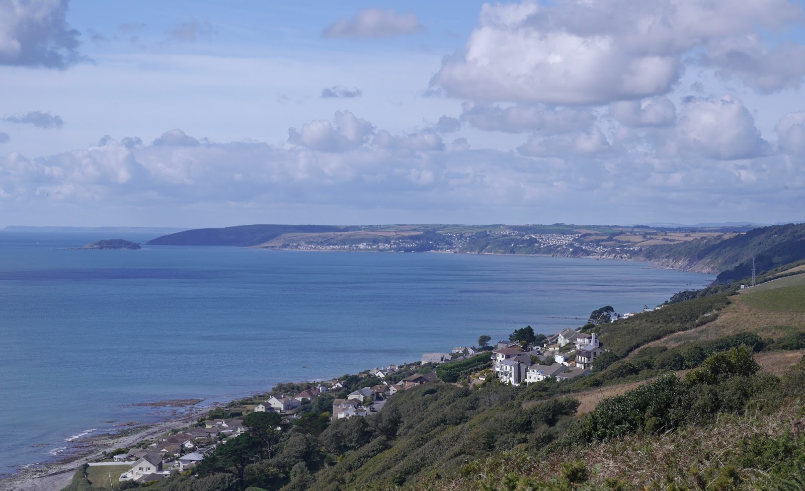
Where Hannafore ends, a gate leads to a large grassy area where the path follows the curve of the coast. We soon realised that, as the SWCP Guide suggests, this was going to be one of the most popular stages of the Path: every few minutes it seemed that another couple would hove into view behind us. Later, after a bit of a climb, there is a nice view across Port Nadler Bay to Looe Island and Rame Head.


Turning the unnamed headland soon brings you in sight of Talland Bay. There is a nice little cafe in this attractive small bay which was doing a roaring trade refreshing the passing walkers.


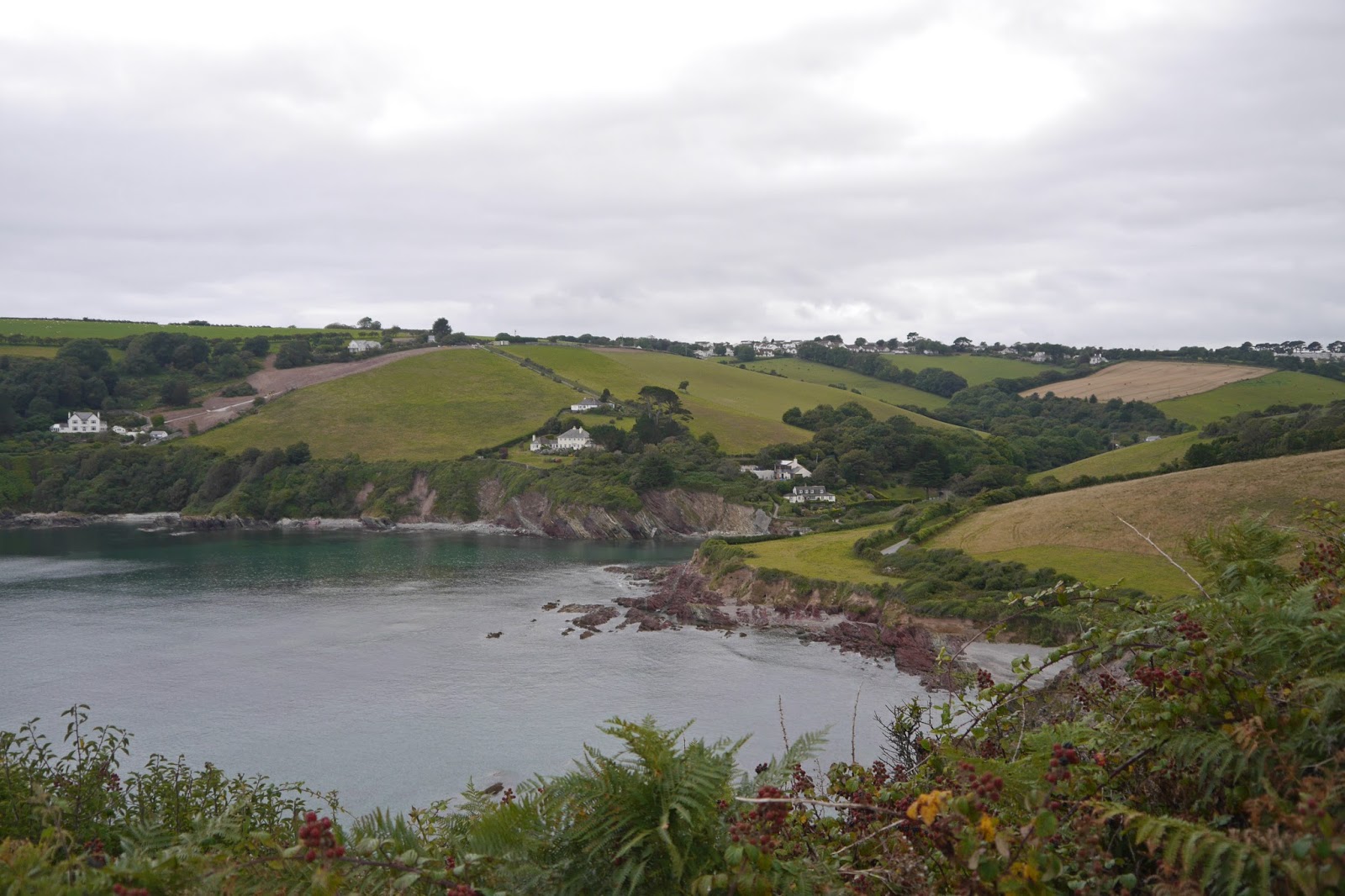
It was now 1.25 miles to Polperro (although an National Trust sign confidently asserted 2 miles). Soon after leaving Talland Bay, the location of Looe could be discerned by plotting the route of the small boats entering and leaving the harbour.


Eventually you turn the corner and get a glimpse of it, but it is not until you are really quite close that the wonderful, picturesque harbour can be fully seen and appreciated.


Polperro dates from the 13th century as a fishing village and the wars of the 18th century bought wealth and fame from smuggling. We had a wander around its narrow streets and then phoned for a cab (unusually from a public call box as there was no mobile signal) and returned to Looe to head home after a splendid four days' walking.

Conditions:  cloudy and grey, cooler than on previous days.

Distance: 5 miles.

Map: Explorer 107 (St Austell and Liskeard).

Rating: Four stars. In truth we didn't enjoy this leg as much as we had expected to. The prevailing greyness was a bit depressing, the path was the busiest we have ever experienced (except on the short section from Lulworth to Durdle Door) and perhaps we were a bit tired.

Tuesday 10 September 2013

42 Portwrinkle to Looe

Looking back towards Portwrinkle

We had ended yesterday's walk at the Portwrinkle car park, so today's leg saw us descending the hill into the tiny village and passing the incredibly small harbour (see above). I have never seen a smaller one, but we did see a boat enter and land, so it is clearly still in use. There now began a long climb, briefly on a road and then on a grassy track.

This climbed quite steadily, but we were pleased to see a number of butterflies, notably a large number of Small Coppers. This one offered an unusual view of the underwings with a little bit of upper wing as well.


I saw a yellow butterfly as well which I think was a Clouded Yellow, but could I suppose have been a Brimstone. The grassy cliffs offered a nice view over the shoreline, with an isolated rock, which I think is the Long Stone, prominent ahead.


From a bit higher up there was another fine view of the east side of Whitsand Bay, back to Rame Head where we started yesterday's walk.


After some gentle ups and downs, we reached the highest point on this section of coast and soon had a fine view of Downderry, our next destination. I was a bit surprised to find that the highest point was only about 140m.


We descended to join the road into Downderry and turned left by the school to take the beach route to Seaton (the other alternative is to continue on the road). It isn't the most beautiful beach you will ever see, but from our experience so far it is quite unusual to walk along a beach as part of the coast path - the other examples which come to mind are Studland, right at the start, and Lulworth Cove.

Downderry beach does feature an unusual mix of grey and red stone and lots of very pretty pebbles. Here is a view towards Seaton, on the right, and Looe island one the far left.


After a very pleasant stroll along the beach, I followed the sea wall round into Seaton (Ange stayed on the beach) and was thrilled to see a couple of Clouded Yellows, which this time I could definitively identify. This is my third sighting in the last few weeks. Yet again I could not manage a photo however.

We stopped briefly at the cafe in Seaton, a pleasant spot, and puzzled over a line of substantial houses which seemed to have been recently built just in from the cove. Who were they for?

We then climbed up the long, steep Looe Hill out of Seaton and were dismayed to find that where you should off the road to take a path to the coast, there was a sign saying that the Coast Path was closed because of active landslips. We plodded on up the hill, noticing some substantial houses and concluding that this must be a desirable residential district. This view was reinforced when we saw a sign pinned to a post requesting help with a lost peahen which "answers to the name of Jubilee".

The hill peaks at a trig point 155m above sea level. The road continues along a high ridge past the Monkey Sanctuary to reach Bay View Farm. Here we made a little foray out on the headland above Bodigga Cliff, the end of the closed section of path. A pleasant grassy picnic area offered a closer view of Looe Island, with glimpses of the town to the right.


The next section, through Milendreath and Plaidy was not too much fun. Mainly residential, mainly road and with an excessive amount of ascent and descent. We were pleased to finally reach a high point offering a view over the beach at East Looe. 


The path goes briskly through the town, but we diverted to see one of its old buildings, the Old Guildhall of about 1500, now a museum.


Along Fore St, the main street, there are number of old houses including some nice half timbered ones with early 17th century dates on them. The most dramatic is the new Guildhall, which looks late Victorian, but I have so failed to turn up any information about it - Pevsner doesn't even mention it.


To me, the two most striking things about Looe are firstly that its original core was clearly planned: the five narrow parallel streets nearest the sea. And secondly, that because it remains a working fishing port, the river frontage is still occupied by fishing operations and associated buildings, which gives the town a curiously enclosed, almost claustrophobic, character.

It was low water when we arrived, so I will end with a more atmospheric view taken in the golden hour after sunset.


Conditions:  warm, sun, clouds.

Distance: 7.6 miles.

Map: Explorer 108 (Lower Tamar Valley and Plymouth) and 107 (St Austell and Liskeard).

Rating: Three and half stars. Seaton to Looe was a bit grim.

Monday 9 September 2013

41 Rame Head to Portwrinkle

Rame Head: St Michael's chapel

We arrived at Rame Head in cloud yesterday afternoon, but today is much brighter. We head west across grassy cliffs round Queener Point towards Polhawn where we pass above Polhawn Fort, now improbably a romantic wedding venue. It was originally one of Palmerston's many defensive forts and dates from 1867. This is the view looking west.


The mid-cliff path leads ahead and gradually rises to a bench near the road. The view back includes on the right the Chapel of St Michael, then the aerials of the Coastwatch station and on the left the delicate tower of Rame church. Polhawn Fort is visible just above and to the right of the cove.


The next section was a surprise. What had looked from a distance like rocky outcrops on the hillside, were revealed to be single story houses: some little more than large garden sheds, others more substantial. The path snaked up and down through a number of these before coming up to the road.  We could see how it would be nice to own one, but we were puzzled that the local authority had ever allowed them to be built.

We walked along the road for a while, a stretch principally enlivened by this spectacular caterpillar.


It turns out to be an Elephant Hawk Moth. The caterpillar is supposed to resemble an elephant's trunk.

A bit further on, past Freathy, it was possible to go out onto the cliff for a short way and enjoy excellent views to the west, right round to the end of Looe Bay ...


... and to the east back to Rame Head. It was instructive to see how beautifully sandy the beach was along a large section of Whitsand Bay.


Shortly it was possible to follow a path parallel to the road for a while and once we returned to it the brooding presence of Tregantle Fort loomed above us. It is yet another fort constructed at the initiative of Lord Palmerston. It was completed in 1865 with barracks accommodation for 1,000 men and provision for 35 large guns. It now seems to be a firing range.


Happily the firing range was not in use and we able to walk through the site - much preferable to the alternative road route around the outside. We saw lots of Small Tortoiseshells on the wild Buddleia beside the path.

You emerge from the main shooting area into fields with a fine view inland. The area of water in the photo is the St Germans or Lynher River.


A view back east taken a little further on demonstrates how rural and unspoilt this section of coast can look.


After a few more fields, we emerge above Portwrinkle. The massive building is the Whitsand Bay Hotel.  The hotel's website reveals its surprising history: it was originally built 6 miles away in Torpoint in 1871 by the 3rd Baron Graves and was known as Thanckes House. In 1909 Thanckes House was pulled down and re-erected stone by stone to open as a hotel in 1910.


As a footnote to this post here are two pictures I took this morning when we parked at Portwrinkle. The first shows the view back to Rame Head under a lovely sky.


The second, more arty, effort shows a ship on the horizon with the Eddystone Lighthouse to its left. The stump of Smeaton's Lighthouse, now rebuilt on Plymouth Hoe, is just visible.


Conditions:  warm, with the cloud clearing to give a clear afternoon.

Distance: 6.8 miles.

Map: Explorer 108 (Lower Tamar Valley and Plymouth).

Rating: Four stars.

Sunday 8 September 2013

40 Plymouth (Cremyll Ferry) to Rame Head

View of the Royal William Victualling Yard

We resume our South West Coast Path adventure, now in Cornwall. We pick up the route at the Cremyll Ferry - there has been a ferry here since the 13th century - admire the naval Victualling Yard across the Sound, and immediately enter the grounds of Mount Edgcumbe Park.

We quickly get a view of the house itself at the top of a grassy avenue. It was built 1547-1553 for the Edgcumbe family of Cotehele (Richard Edgcumbe was knighted at the battle of Bosworth and the family later became Earls of Mount Edgcumbe). The house was gutted by German bombing in 1941, along with the centre of Plymouth, and rebuilt in the late 1950s.


The grounds are delightful. Our selective tour takes us past the Orangerie (1760) ...


... and out onto a broad promenade with a view across to Drake's Island.


A grassy section ends with Milton's Temple of 1755. There is a plaque inscribed with lines from Paradise Lost, 'overhead up grew, Insuperable heights of loftiest shade.....'


Then you enter the Deer Park and soon spot a splendid folly on a hill. It dates from 1747 and was built from medieval stone taken from the churches of St. George and St. Lawrence, Stonehouse.


At Redding Point there is good view of the Plymouth Breakwater with the Breakwater Fort behind it. We first encountered this on the Warren Point to Mount Batten leg of the Coast Path.


Now you pass through woodland high above Fort Picklecombe. This was one of the many forts which Lord Palmerston had built to defend against a feared French attack in the 1850s. It has been a residential complex since the early 1970s.

The woodland gave way to a section of low grassy cliff top leading to the twin villages of Kingsand and Cawsand.


Cawsand is the larger of the two and has attractive narrow streets and this fine clock tower. It was erected to commemorate the coronation of George V (1901) and the building it is attached to (locally referred to as the Institute) is used as a community hall.


We climbed up Pier Lane and the sight of the name also in Cornish (Bownder an Kay) brought it home to us that we were in Cornwall. We then passed in front of the one-time Cawsand Fort, dating from the 1860s, but on the site of an earlier battery - it is also now a residential development.

More grassy cliff tops brought us to Penlee Point, which marks the entrance to Plymouth Sound. Here the terrain changed and the final section to Rame Head was along a hedged track, with dense gorse and scrub below. We saw a vast number of Speckled Woods as we walked along.


We were very interested to get our first sighting of the Eddystone Lighthouse as we walked along - too far out to photograph in the gathering gloom. I will try tomorrow. We had of course seen Smeaton's Tower, the the first stone lighthouse there, relocated on Plymouth Hoe.

This stage ends with a view of the Chapel of St Michael, consecrated in 1397, perhaps on the site of an earlier hermitage.


Behind it, on higher ground, is a Lookout Station of the National Coastwatch Institution. Although Coastwatch sounds like an idea for a BBC TV programme, the Institute is a charity which provides volunteers to man Lookout Stations like this which the Coastguard ceased to operate in the 1990s.

Conditions: becoming increasingly cloudy, but quite warm.

Distance: 6.5 miles.

Map: Explorer 108 (Lower Tamar Valley and Plymouth).

Rating: Four stars. Mount Edgcumbe Park was a joy.