Showing posts with label butterflies. Show all posts

Wednesday, 12 July 2017

99 Combe Martin to Hunter's Inn


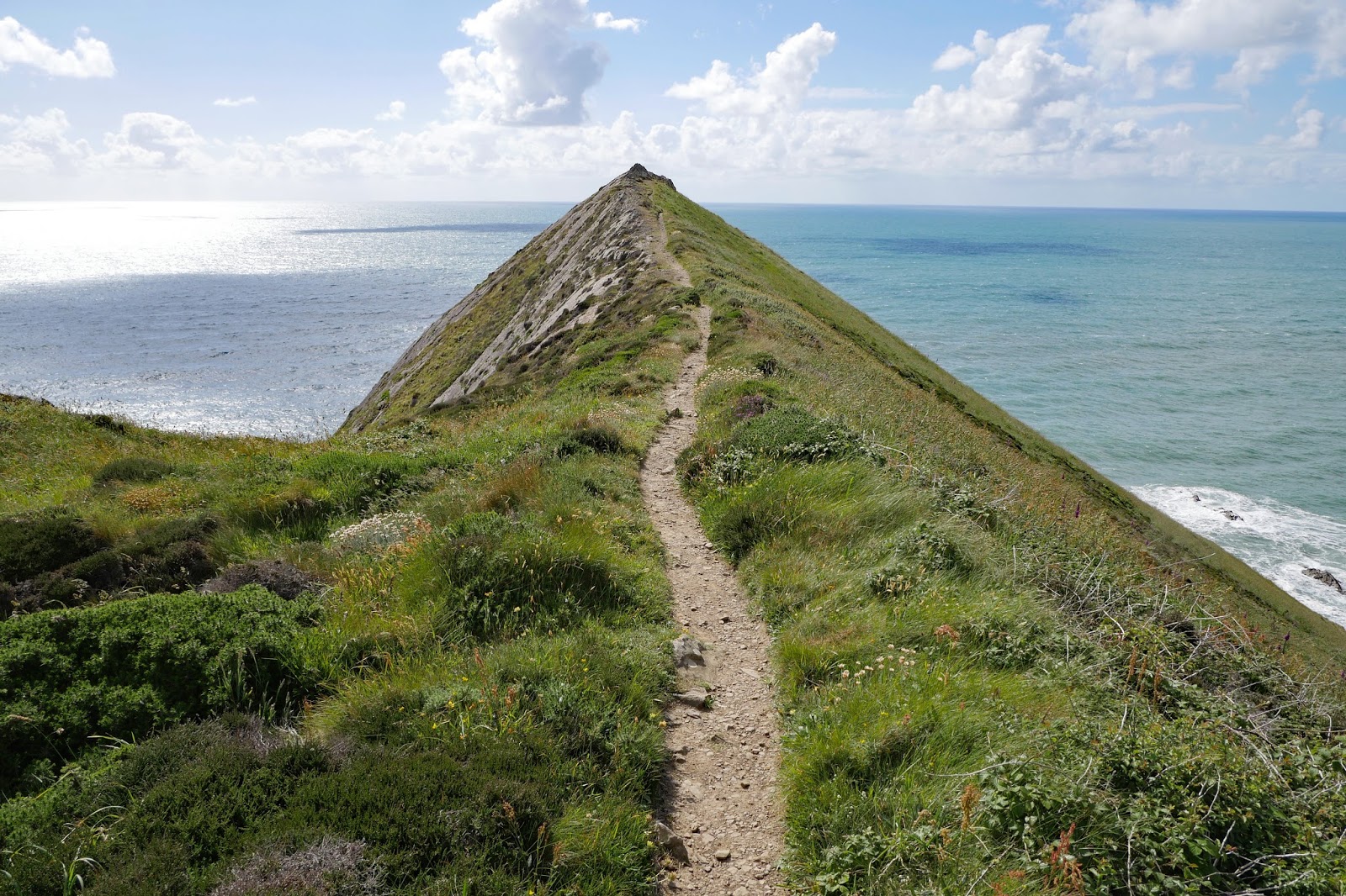
The Little Hangman and Hangman Point

Five more stages to go! We set off from Combe Martin and began the long climb which continues to the Great Hangman. Immediately, we saw our first Gatekeeper of the year, appropriately enough by a gate.


As we passed inland of the Little Hangman (not so little at 218m) we enjoyed lovely views back to the west across Combe Martin Bay towards Watermouth Castle and Burrow Nose.


And a bit further along, a few houses in Combe Martin became visible as well.


Now the Great Hangman lay ahead.


We were surprised to see a fox wandering along the track ahead of us, but it soon got wind of us and hurried off.


As the climb continued, the views back became ever more wonderful.


And eventually we reached the simple, but rather large cairn which marks the summit at 318m. This makes it not only the highest point on the South West Coast Path, but the highest sea cliff in the whole country.


The path down looked straightforward, but we soon realised that we were being forced a long way inland to be able to cross the steep and very deep Sherrycombe. We descended steadily on a diagonal line towards the bottom of the combe and then climbed up the other side towards a plateau at about 260m.


On the way down we began to see some large fritillaries and I was pleased to get a good shot of a Dark Green Fritillary on a thistle on the way up. Another first of the year.


Later we hit a stony section and were rewarded by the sighting of several Graylings, the third first. There has also been lots of Meadow Browns and Ringlets and a smattering of others.


We were now on a classic level path two-thirds or more up the cliffside.


We continued alon g in this way towards the imaginatively named High Cliff.


As we approached Heddon Mouth it was fascinating to see a sudden change in the cliff - it became a great deal more rocky. But at least we could continue on the level high path.


Suddenly we turned a corner and the Heddon Valley stretched out in front of us as we looked into the sun.


The high path gradually descended towards the valley bottom and the River Heddon.


At the bottom we followed the track down to the lovely Hunters Inn where we were staying.

Conditions: Warm and sunny.
  Distance: 7.3 miles.
  Map: Explorer OL 9 (Exmoor).
  Grading:  Strenuous.
  Rating: five stars. A wonderful section

Monday, 5 June 2017

98 Ilfracombe to Combe Martin

Ilfracombe from Beacon Point

We start this leg of the Coast Path at the back of the harbour in Ilfracombe. Ilfracombe is an interesting place and I have done a separate post about it. We walked along the landward side of the harbour. The tide was out, but the inner harbour was still attractive.


The outer harbour looked even more bereft.


We then headed up hill along a road and turned left into what felt like a park to emerge at this small cove. We wondered if we had gone the wrong way at first as we couldn't see a path upward (you can in fact just make out a handrail to the left of the concrete shelter. Fortunately a couple of chaps enjoying an early morning can of beer in a sort of belvedere to the left put us straight.


We climbed steeply up from the cove and continued a steady climb through trees and then more open ground over what the map shows as Fort Hillsborough. It seems to be named for an iron age chieftain called Hele. There were lovely views back over Ilfracombe and I used one of then to head my post about Ilfracombe. The best view however came from above Beacon Point (at the head of this post).

Now we descended through woodland along a winding path to finally emerge at Hele. The village was apparently once had a gas works (it closed in 1963) which was for many years supplied with coal by ships which moored at the wooden post which can be seen on the beach.  By the 1950s it had become a popular holiday destination (the coal now being delivered by road) and it was normal to have 200 deckchairs on the beach. And as the photo shows there is a rather tasteful collection of holiday chalets there now. the beach however is more like gravel than proper sand.


We climbed up the hill on a footpath beside the A399 road which continued just the other side of a crash barrier. We eventually took a left which led to the low-lying Rillage Point and then climbed. On the horizon the coast of South Wales stretched out before us.


I spotted a rather lovely Peacock and was quite pleased with this picture taken with the lens I normally use for landscapes and buildings, rather than the usual big zoom.


Soon we had a great view of the west side of Widmouth Head. No doubt we would soon be climbing the steep path on the left hand side.


And so it was. This is the view from the top of the path. In truth it wasn't too bad.


The view east from the highest point of Widmouth Point was wonderful. The narrow cove is called Water Mouth (a bit generic as name, I thought) and the peninsula to the left is The Warren. Hangman Point can be seen in the background. The Great Hangman at 318m is the highest sea cliff in England.


We enjoyed a nice break on Widmouth Point and saw a couple of Painted Ladies, neither of which would pause for a picture. I did get a nice one of a Stonechat however - we have seen lots of them is recent days.


We descended fro Widmouth Head to follow a path through woodland above Water Mouth and emerge opposite Watermouth Castle. This was begin in 1825 but not completed until many year later. It is now a family theme park, although this is not too evident from the road.


A little further on we left the road and walked uphill through a large, but mercifully empty, campsite. We then followed a high level path with at one point a wonderfully beautiful small cove down below. We later saw an access path.


Later the path was diverted so that we had to follow a road for a while as we meandered into Combe Martin. This was our first view. Around the corner is a sandy, but not all that attractive beach.


Conditions: Warm and sunny.

Distance: 5.3 miles.

Map: Explorer 139 (Bideford, Ilfracombe & Barnstaple).

Grading:  Moderate, Strenuous in places.

Rating: four stars.

Sunday, 21 May 2017

94 Barnstaple to Braunton Burrows

The Long Bridge, Barnstaple

Day three of our Coast Path trip and we set off from Barnstaple's handsome Long Bridge in bright sunshine. It may not be as long as Bideford's, but it is older, dating from the 13th century, although since widened.

Immediately we passed a pair of art deco buildings, the one on the right (presumably originally a cinema) was especially impressive.


Further on, at right angles to the river, was this curious structure capped by a statue of Queen Victoria, and now derelict. I haven't been able to discover what it is. To the right is a fine warehouse or grain store.


Continuing along by the river, and still following the Tarka Way as well as the Coast Path, we came upon another former railway station, this one imaginatively turned into a primary school.


Soon afterwards there was another view of the impressive Taw Bridge, which we admired from the other side on the other bank yesterday afternoon.


Soon we had crossed  the road by the bridge and left the town behind. The wide estuary was at low tide again although the river still ran shallowly in a wide arc.


We started to hear and see quite a few birds in this area and were delighted to see a pair of curlews patrolling the shoreline and the shallows.


The first landmark was this fine pub, the Braunton Arms, marked on the map as Strand House.


Here is a further view of the river at low water.


The next section gradually diverged from the river bank and brought us to Chivenor, where all that remained of the railway station was these signals permanently set to go. The station site had been redeveloped as houses.


Now on the left we passed the Royal Marines Chivenor barracks, which seemed to occupy a massive site. We we surprised to see signs on the perimeter wall that security was provided by a private security company. Surely the Marines could handle that? But no doubt it makes sense.

We were no on the outskirts of Braunton and suddenly a new type of environment opened up. This was our first sight of the River Caen, which flows into the Taw.


We followed the right bank of this small river. Off to the right was Braunton Great field. When we drove past it later on we were struck by scattered stone buildings of a very medieval style known as linhays - they made a great sight and I wish we had been able to stop to take some pictures. I now know from Pevsner that the Great is one of the very few remaining fields in the country still farmed on the medieval strip system. The presence of several small waterways gave it something of the character of the Somerset Levels.

There was a diversion in operation and we walked along the top of a sort of dyke with a minor road and a waterway (marked as Drain on the OS map) on our right. It was very flat to right and left.


At one point we spotted a swan's nest on a pile of rushes where a waterway came in from the right. The Braunton Burrows can be seen in the background.


This walkway ended at Crow Beach House and we then followed a stony track up to and into the Burrows. We followed this for almost two miles to reach Sandy Lane car park. It was a bit frustrating to not be able to see the sea or even walk through the dunes as the path was set well back.

I did however see my first Speckled Wood of the year, perhaps a bit earlier than usual.


Distance: 9.0 miles.

Grading: Easy.

Map: Explorer 139 (Bideford, Ilfracombe & Barnstaple )

Rating: four stars. A bit frustrating to not see the sea, and quite a lot of tarmac at first, but some nice elements all the same.

Saturday, 25 March 2017

85 Duckpool to Morwenstow

Duckpool Beach and Combe Valley

We have arrived in Cornwall with a plan for three days walking, but immediately had to modify it because we couldn't find a taxi to meet us at the end of the walk we planned. We are staying at the excellent Bush Inn and Morwenstow and fortunately the owner there was able to find us a taxi back to Duckpool.

We set out from there to walk to Morwenstow and climbed the hill to Steeple Point, enjoying a fine view back along the coast of Bude Bay to Bude (we will do this section on Monday before we go home).


At the top of the climb there was a helpful waymark indicating we should turn right rather than throw ourselves over the cliff top. The waymarking on the Coast Path is generally very good, but this one was perhaps superfluous.

The rocky coast stretched ahead …


 … and after a short climb there was an even better back along Combe Valley.


For a while we would mainly walk along the cliff top. And soon we would have our first view of what is marked on the OS map as "Radio Station", but seems to be widely acknowledge as GCHQ Bude.  We emerged onto a grassy plateau and could see the various structures more clearly.


Our taxi driver told us that the round one was covered in Kevlar, one of the functions of which was to prevent interested parties knowing which way the radar dish inside was facing. He said had he learned this on an annual open day.

I was delighted to spot my fourth Painted Lady of the year on this grassy area, but as ever it didn't hang around long enough to be photographed. We were starting to see a few Common Blues and Small Heaths and a few instances of this as-yet unidentified caterpillar.


At Stanbury Mouth we had a sharp descent to sea level and a great view inland.


On the other side, there was a very steep climb, but a great view back at the top over Stanbury and Rane beaches.


Soon there was more excitement with Green Hairstreak number 2 of the year. 


We would also see several Speckled Woods and a lone Small Copper and Large Skipper (the first of the year). Soon afterwards we reached the back of Higher Sharpnose Point. 


The view of the point looking directly out to sea was rather wonderful.


At the back was a semi-ruined hut, presumably once used by the Coastguard. Off to the right was the next high cliff, unnamed on the map, which had clearly suffered some recent rock falls.


We had already been told by some very pleasant local walkers we met that the path was blocked ahead and when we descended to Tidna Shute we weren't surprised to find that here was the blockage point: the cliffs were now regarded as unstable and a diversion inland to Morwenstow was required. We headed inland along the path of the tiny River Tidna, initially in open county and then in woodland. After about half a mile a steep path to the left brought us to the edge of Morwenstow and the pub.

Conditions: Grey at first, becoming bright and sunny.


Distance: 3.5 miles.


Map: Explorer 126 (Clovelly & Hartland)

Grading: Severe. 
Rating: five stars.