Friday 6 April 2012

20 Charmouth to Lyme Regis

 Charmouth

When we started the Coast Path in January last year we thought we might eventually get to Weymouth or perhaps even Lyme Regis. Here we are 15 months later about to do the short leg from Charmouth to Lyme and finish the Dorset section. Basically, we are hooked.

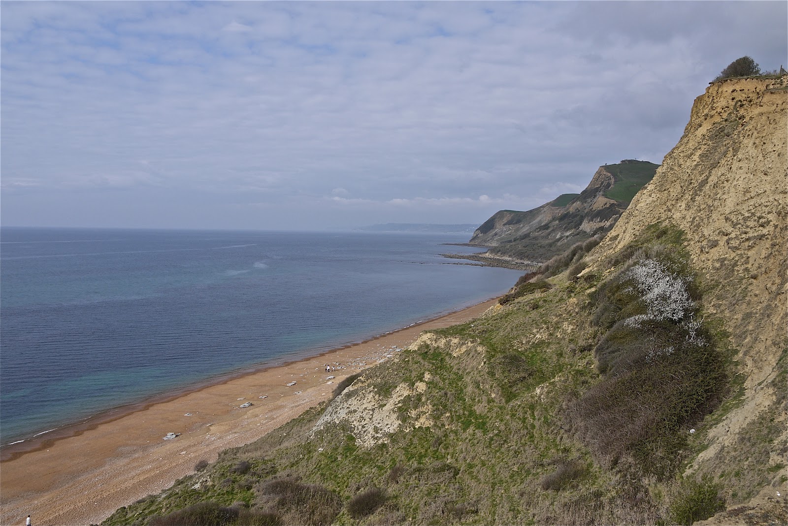
We picked up the route at Charmouth's beach car park and admired the immaculate line of six tastefully-painted beach huts. Then we spent a few minutes locating the departure point of the Coast Path (pass the Visitor Centre on the seaward side and turn half right up the slope), pausing to admire the sweep of the beach.


The route to Lyme is rather odd, involving a long-standing, but erratically signposted, inland route. You walk up from the beach to find the main street, The Street, well-named, and follow this west to turn left on the road to Lyme. Just as you think it may be road all the way, you turn left by the Fernhill Hotel uphill through woods and across a golf course to regain the road much nearer to Lyme. After a bit more road and cutting a corner through a bluebell wood, you descend into Lyme down a grassy hillside. Soon, there is a fine panorama, rather misty today, over the town with the famous Cobb to the right.


You rejoin the  road again to enter the town centre and pass the rather odd-looking church of St Michael the Archangel. There is evidence of Saxon and Norman construction and the nave dates from 1531. The rather unfinished look is due to a restoration of 1933 which was left incomplete due to lack of funds.


Round the corner, the narrow Church Street is closed by the Guildhall, with the Marine Theatre on the left.


And round the corner is the Museum, an exuberant building of 1901, built on the site of the home of pioneer fossil collector Mary Anning, whose life was novelised by Tracy Chevalier in her novel Remarkable creatures. Rather delightfully, the architect was Thomas Philpot, nephew of Elizabeth Philpot who also features strongly in the novel and in Mary Anning's life.


We followed the Coast Path along the back of Marine Parade, detoured for a wonderful celebratory lunch at Hix Oyster and Fish House ...


... and completed our walk by going to the end of the Cobb.


Conditions: cloudy after early-morning rain and never quite managing to clear.

Distance:  3 miles. Distance covered now 86.5 miles.

Map: 116 (Lyme Regis and Bridport).

Rating: three and a half stars.

Wednesday 4 April 2012

19 Eype Mouth - Golden Cap - Charmouth

Thorncombe Beacon

We returned to the Coast Path after a two month lay-off and picked up the route at Eype Mouth. The path almost immediately begins to climb towards Thorncombe Beacon. There is a sort of brazier at the top (157m) and it turns out that its use as a beacon dates back to 1588 as one of the chain which brought news of the Spanish Armada to London. The beacon was restored in 1989.

The view back along the beach clearly shows the twin piers of West Bay.


We then descended a little and climbed to the next high point, Doghouse Hill, where the view back dramatically illustrated the extent of erosion on Thorncombe Beacon.


A bit further on we began the descent to Seatown (not to be confused with Seaton, further along the coast in Devon).


Here you are forced a bit inland, along a lane, across a field and through some woodland before the way opens out to Golden Cap, well-known as the highest point on the south coast at 191m. The name derives from the distinctive outcropping of golden greensand rock at the top of the cliff.


When you get to the top there are first of all fine views back to the east, with the beach to both sides of Seatown in the foreground.


One of the nice things about Golden Cap is that the top is quite extensive, so having made the climb up you stroll along a wide flattish area for a couple of hundred yards before you have to descend. Just as you do, there is another fine view to the west over Lyme Bay.


Soon you spot the ruins of St Gabriel's church a few hundred yards inland. It apparently dates back to 1240. This is all that remains of the lost village of Stanton St Gabriel. I have read that the main road was moved a mile and a half inland at some point, because of coastal erosion, and that this was the cause of the village's demise.


Around this point we saw a sign saying 2 miles to Charmouth. This proved to be inaccurate and created  a sense of the final stage of the being an unending series of ups and downs - a pair of later signs showing a mile and half in each direction confirmed our suspicions that it was really three miles. Still, there were many fine views back to Golden Cap.


Also including this one, which dramatically illustrated Tristan Gooley's (author of the Natural Navigator) concept of the "comb-over" effect of prevailing winds on tree growth.


Finally, we gained a good view over Charmouth and Lyme Bay.


We had followed the original line of the coast path all the way, but only right at the end did we discover that it had been diverted inland as the result of a landslip in December 2010. Fortunately for us, people coming from Charmouth had created a desire path at the back of the landslip, so we did not have to retrace our steps. It seems that somebody had missed an opportunity to sign post the diversion. It is very clearly indicated coming out of Charmouth.

Conditions: cloudy, sunny intervals, threat of rain.

Distance:  6.5 miles. Distance covered now 83.5 miles.

Map: 116 (Lyme Regis and Bridport).

Rating: four stars.


Sightings

Three Speckled Woods. And possibly a warbler of some sort - I will have to get my bird DVDs out when I get home. It had a distinctive song, but a drab appearance.