Showing posts with label West Cornwall. Show all posts

Saturday, 28 March 2015

69 Godrevy Point to Portreath

Seals in Mutton Cove near Godrevy Point

We picked up the Coast Path at Godrevy Point and headed on along the high (say 60m) cliffs. We noticed that a section of the cliff edge had a wooden barrier. On it were the words "Please speak only in whispers. Any sudden movement or noise can disturb the seals." Seals? We looked down and there stretched out across the sandy beach of Mutton Cove were maybe 70 Grey Seals.

We have had a few glimpses of Grey Seals at other points on the Coast Path, but to see such a large group was a real joy. They were mostly motionless, but every so often one would move awkwardly across the sand. These two seemed to be engaged in foreplay.


Soon the route entered a new environment: heathland. This is the view looking back over beautiful bright yellow broom towards Navax Point.


The coast gradually becomes more rocky.


But for the time being you continue on a cliff top path, now about 85 m above sea level, with a wide plateau inland. The coast stretches out ahead apparently promising more of the same.


Things change a bit further on with the Crane Islands in the foreground and the Samphire Islands beyond. In between lies a classic Coast Path descent to near sea level followed by a steep climb. You can see the gap in the cliff top on the right of the photo.


By now the rain which had been threatening for a while caught up with us as we made another descent and ascent at Carvannel Downs.

Finally we reached Western Hill overlooking Portreath and made our way down to the car park where we had left the car.


Conditions: not cold, but wet and grey.

Grading: Moderate.

Distance: 7.5 miles (distance now completed 415.0 miles).

Map: Explorer 102 (Land's End) and 104 (Redruth and St Agnes).

Rating: four stars.

Friday, 27 March 2015

68 Hayle to Godrevy Point

We picked up the Coast Path again in Hayle and crossed a bridge to head along the North Quay. Behind us was the rather lovely church of St Elwyn. It dates from 1886-8 and was the work of J D Sedding, the architect of Truro cathedral and of the restoration of St Uny, across the estuary. In front of the church was the delightful Church Hall of 1905, looking like a church itself.  I am describing this rather than presenting a photograph because it was already raining, in sharp contract to the lovely weather yesterday evening.

Once we were clear of the quay we passed through an area of holiday homes, some ramshackle and other quite imposing. This was Hayle Towans, a towan is a sand dune. The rather urban route continued into The Towans and then, more exotically, Mexico Towans.

At the end of Mexico Towans, the path follows the back of the enormous sandy beach through the sand downs, now un-named. It was hard going with constant ups and downs over often quite soft sand. There were numerous parallel paths and it was hard to be sure that you were on the right one - but perhaps it didn't really matter.

As we headed further north we began to notice a nice line in slate waymarks pointing the way ahead over the dunes. The rain had finally stopped so it was possible to take a photo.


After Gwithian Towans, the sandy Godrevy beach stretched out ahead, with various random walkers and kite fliers offered a bit of interest.


At the end of the beach you begin a more conventional section of coastal path which leads round to Godrevy Point. Just off the Point is Godrevy Island which houses a still operational lighthouse of 1858–1859.


At Godrevy Point we called it a day.

Conditions: not cold, but wet and grey.

Grading: Moderate.

Distance: 4.2 miles (distance now completed 407.5 miles).

Map: Explorer 102 (Land's End).

Rating: three and a half stars.

Thursday, 26 March 2015

67 St Ives to Hayle

Porthminster Beach, St Ives

It's the start of of our annual progression along the South West Coast Path and we pick up the route by St Ives station, overlooking the beautiful Porthminster Beach. The path runs above the beach and then climbs further towards Porthminster Point. As you progress St Ives harbour opens itself up to view.


Beyond the point lies the equally sandy Carbis Bay.


You descend to just behind the beach and climb again to emerge overlooking Port Kidney Sands at the mouth of the Hayle River.


The path follows the dunes at the back of this vast sandy area and turns inland to follow the estuary. The tower of St Uny's church at Lelant dominates the view. According to Pevsner, Lelant was an important sea port in medieval times. The church is originally Norman, but mainly 15th century with late Victorian renovation by J D Sedding, the architect of Truro Cathedral.


Soon there is a good view across the estuary towards Hayle.


After the church the route becomes more suburban as you pass through new housing developments and then follow the road around the edge of the wide estuary into the town of Hayle. The last couple of miles are a bit boring to be honest.

Conditions: beautiful late afternoon sunshine.

Distance: 6.1 miles (distance now completed 403.3 miles).

Map: Explorer 102 (Land's End).

Grading: Easy.

Rating: three and a half stars.

Wednesday, 10 September 2014

66 Zennor to St Ives

 
Looking west towards Gurnard's Head

 One of the features of this section of the coast path is that there are no settlements at all on the coast, so you have to start from somewhere a bit inland. Today we are starting from the hamlet of Zennor, which does boast an excellent pub and a handsome church.

We walk less than a half mile to reach the coast and enjoy fine views to the west past Pendour and Veor coves towards Gurnard's Head.

Ahead lies Zennor Head, with fine rock formations behind the carpet of heather and broom.


The view west from the Head is quite inspiring. Pendeen Watch is just visible on the horizon, to the left of Gurnard's Head.


 Once you turn the Head, the view forward is of inaccessible sandy beaches. The terrain becomes increasingly rocky and laborious. There was however a sustained stream of people coming towards us, making this one of the busiest sections of path since Looe to Polperro, almost exactly a year ago.


 The next section is a bit easier walking as we pass inland of Carn Naun Point, Pen Enys Point and Hor Point.


As we descend towards the near sea level Clodgy Point there is a wonderful view of St Ives, with Porthmeor Beach prominent and The Island to the left. St Ives Bay can be made out in the background.


Once we reach St Ives, we start with a delightful lunch at the Porthmeor Beach Cafe and then visit the Tate. I am not really a fan of abstract art and I must confess that I found the collection rather a disappointment: it is hard to understand why some of these daubs are superior to others. The building is quite impressive though, with its dramatic peristyle entrance.


We walk around the Island and pass Porthgwidden Beach.


Then we head down to the harbour. Reaching the West Pier we are entertained by some young people unaccountably jumping into the sea.  There is a nice view across the harbour towards Smeaton's Pier.


Smeaton's Pier was built between 1667 and 1670, and was lengthened, and the new lighthouse added, in the 1890s. John Smeaton, the first man to call himself an engineer, was also the designer of the Eddystone Lighthouse which we encountered rebuilt on Plymouth Hoe.

We head inland a little to see the church of St Ia, consecrated in 1434. Its fine tower is a local landmark.


 Soon afterwards we reached the fine sandy Porthminster beach before finishing our walk at the railway station. 

There was a great view back over the harbour in the evening sunshine.


Conditions: warm and sunny.

Distance: 6 miles (distance now covered 397.2 miles).

Map: Explorer 102 (Land's End).

Grading: Severe.

Rating: four and a half stars.

Tuesday, 9 September 2014

65 Trevean Cliff to Zennor


Trevean Cliff

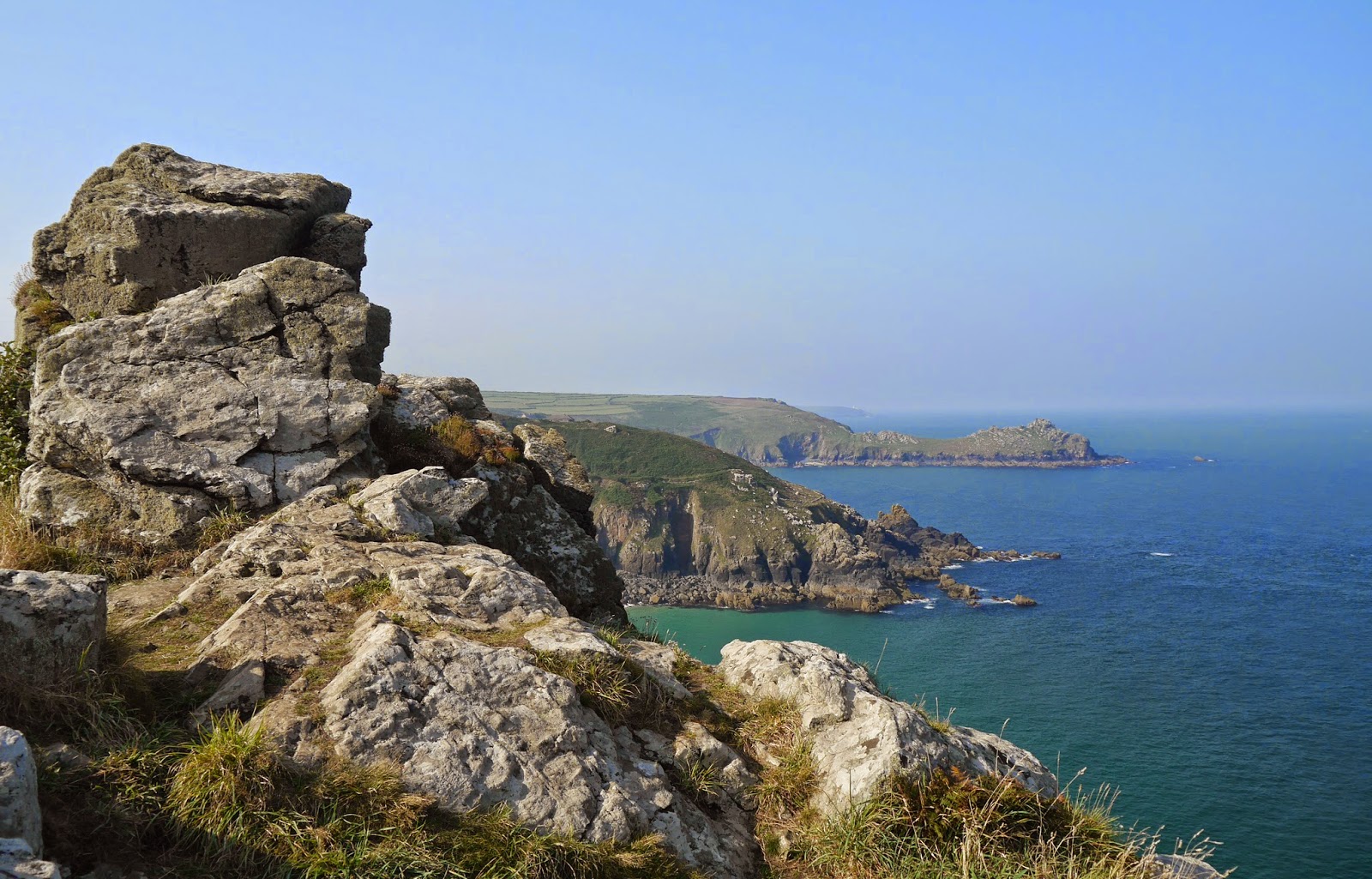
We resumed the Coast Path at Trevean Cliff and headed west across a wild and rocky hillside, soon encountering some wild ponies on the path


Bosigran Cliff was especially savage-looking. In the distant background Pendeen Watch remained visible.


A little further on, we were walking along a level cliff-top path when glancing down we saw half a dozen climbers on their way up a nicely angled cliff down at sea level.


Shortly after this we descended to the isolated and very pretty Porthmeor Cove. At the back of the beach a large single slab of stone has been used to bridge the small stream stream that flows into the sea here.


The next headland had another spectacular rock formation, vaguely suggestive of an enormous camel. I was disappointed not to find Camel Rock marked on the map.


Now we had reached the best-known feature of this section of coast, Gurnard's Head. The resemblance to the head of a gurnard is perhaps not completely obvious in this photo, which does however convey how stark and inhospitable it is.


Passing behind the head, we came to the wonderful sandy beach of Treen Cove, with what seemed to be ruined chapel on the hillside behind it. We were surprised to see a private house sitting just above the beach, an outpost of the hamlet of Treen just inland.


 On the other side, the view back towards Gurnard's Head was spectacular, and perhaps the resemblance was clearer too.


 Having cleared one more headland, we had a great view of Zennor Head, with the twin sandy beaches of Veor Cove and Pendour Cove before it.


It still took some while to reach Zennor as the path snaked inland and then right down towards sea level behind Pendour Cove, necessitating an arduous climb before reaching the path inland to Zennor. Here we had an excellent lunch in the very good Tinners Arms pub.

Conditions: warm and sunny

Distance: 5.4 miles (distance now covered 391.2 miles.

Map: Explorer 102 (Land's End).

Grading: Severe. Very rocky with lots of climbs and descents.

Rating: four stars.

Monday, 8 September 2014

64 Cape Cornwall to Trevean Cliff


We set out inland from Cape Cornwall up the right side of the Kenidjak valley. There was soon a wonderful view back towards Cape Cornwall.

The view up the valley reveals its industrial past. There was once a whole series of tin mines with water and steam power used to drive processes for cleaning and purifying the ore.


A second view down the valley from higher up the valley offers a further dramatic view towards Cape Cornwall.


We headed along the cliff top past the insignificant remains of Kenidjak Casle towards the even more industrialised area of Botallack. The engine houses at the bottom of the cliff are especially dramatic. The mine of course extended out under the sea.


The path continued across heathland to reach Levant Mine, now owned by the National Trust. A series of three chimneys made an impressive sight. I was, perhaps rather fancifully, put in mind of photos I have seen of the Greek temples in Agrigento, Sicily.


We descended through a large area of industrial archaeology, passing also the modern Geevor tin mine on the right, to come in sight of the lighthouse at Pendeen Watch.


As we approached, I was thrilled to make two further sightings of the immigrant Clouded Yellow (we saw some yesterday as well). After a pleasant break for lunch on a bench near the lighthouse, we headed on along the north coast. We were delighted to spot a couple of seals just near the shoreline as we looked down towards the sea.

The view ahead towards Gurnard's Head was delightful.


The immediate target was the perfect Portheras Cove, the tip of whose sandy beach can just be seen on the right above.


It was a steep climb up from there but the next section was an easy stroll across heathland towards our endpoint. The indented coast continued to be dominated by Gurnard's Head. 


Soon after this we found the footpath up to where we had left the car.

Conditions: warm and sunny.

Distance: 6.5 miles (distance now covered 385.8 miles).

Map: Explorer 102 (Land's End).

Grading: Moderate.

Rating: four stars.

Sunday, 7 September 2014

63 Sennen Cove to Cape Cornwall


After yesterday's most enjoyable interlude in Topsham, we resume the Coast Path at Sennen, looking along the fine expanse of golden sand.

We climb away from the back of the beach and soon have a view along the coast to today's destination - Cape Cornwall.


The end of Whitesand Bay, Aire Point, is notably rocky as we pass beneath it.


Round the corner we come on a new landscape of rocky, sloping cliffs covered in broom and two types of heather. I am thrilled to have three separate sightings of the elusive Clouded Yellow, a non-native butterfly which is however a fairly frequent migrant to southern England.

The next section is similar, but for this beach of round white stones.


Turning the headland of Maen Dower we get a surprise. There is a sudden mass of sandstone: Gribbin Point. 

Beyond this, the path zig zags down towards sea level and then arrives at Nanven. A car park means that there are suddenly more people about, sunning themselves on rocks. We are forced inland along the Cot Valley. Looking back, there is a fine view out to sea where the rocks known as The Brisons fill the V of the cliffs. 


After heading inland, we climb to the top of the cliff and head back toward the sea. A series of former mine shafts have an air of medieval fortifications.


After another half mile we are at last at Cape Cornwall, apparently the only cape in England. The apparent tower is in fact an old mine chimney. The Brisons are again offshore.


What then is a Cape? A bit of Googling produces definitions along the lines of a piece of land projecting into the sea, with the origin being the Latin word for a head. The Wikipedia entry for Cape Cornwall says that a  cape is the point of land where two bodies of water meet, which seems a bit more specific.

So what about Cape Cornwall? According to the Cornwall Calling website, the two bodies of water are the English Channel and St Georges Channel. However, St George's Channel is generally understood to run between Ireland and Wales, connecting the Celtic and Irish Seas. I am going to go for the English Channel and the Atlantic.

Interestingly, Wikipedia adds that until the first Ordnance Survey, 200 years ago, it was thought that Cape Cornwall was the most westerly point in Cornwall.

Conditions: warm and sunny.

Distance: 5 miles (distance now covered 379.3 miles.

Map: Explorer 102 (Land's End).

Grading: Moderate.

Rating: four stars.