Friday, 14 July 2017
101 Lynton to County Gate
We set out from our hotel in Lynton and, perhaps controversially, took the wonderful funicular down to Lynmouth.
The funicular is water-operated, 862 feet (263 m) long, operating on a 1 in 1.75 gradient track. One car descends, while the other ascends, on a counterbalance system. The water is piped from the West Lyn River. It was opened in 1890 (information from Wikipedia).
We walked past the small harbour with its lovely Rhenish tower.
Soon the path took us into woodland to begin the long climb out of the town. After some zig-zags the path emerges onto the cliff side just below the road and the ascent continues, offering fine views over Sillery Sands.
Just before you reach the church of St John the Baptist at Countisbury (an 18th-19th century rebuilding of an older church) there is a great view of the shoreline of Sillery Sands.
The church enjoys a wonderful position.
The path levels out for a while as you walk above the grey sand beach. Then you start climbing again to pass just under the summit of Butter Hill (302m) where there are some lovely views back to Lynmouth/Lynton.
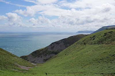
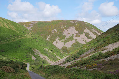
Now there is a bit a descent and then the path winds inland behind the great bulk of Foreland Point. There are great views down Caddaw Combe towards South Wales.
We followed the path on the right and then descended to the bottom of the valley and climbed again behind the coastal cliffs.
At the top we can see east as far as Hurlstone Point.
Once we entered the next zone - Glenthorne Cliffs - there was a fine view back towards Foreland Point.
The path which continued through Glenthorne Cliffs was predominantly woody with the path winding along a mid-cliff level around a series of combes. Just before Wingate Combe, we passed the worryingly named, but unimpressive, Desolation Point, photographed into the sun unfortunately.
After this, the path continued on the same line but now with the slopes mainly covered in rhodendrons. At length we emerged through a rather wonderful gate (note the pigs on the top) and realised that we had been walking through the grounds of Glenthorne House.
I haven't been able to discover much about this mysterious house except that it is Neo-Tudor house built 1829-30 for the Reverend Walter Stevenson Halliday. I would love to know the story behind the pigs' heads.
We headed uphill through woodland to pass this intriguing cross.
From here, a grassy track led uphill to the A39 and the boundary between Devon and Somerset. The County Gate car park is off to the right.
Conditions: Warm and sunny.
Distance: 6.2 miles.
Map: Explorer OL 9 (Exmoor).
Grading: Moderate to Strenuous.
Rating: four and a half stars. Dramatic at first. The area around Foreland Point was wonderful. A bit more mundane later, but always enjoyable.
Labels:
North Devon
Subscribe to:
Post Comments (Atom)


No comments:
Post a Comment